Quantcast
Channel: MY WAY...
Viewing all 42 articles
Browse latest View live

Pengembaraan di Lembah Kinta (Bahagian 1)

$
0
0
Baru-baru ini saya telah melakukan satu ekspedisi pengembaraan dalam usaha untuk menyelusuri tinggalan-tinggalan sejarah yang terdapat di sekitar negeri Perak Darul Ridzuan. Beberapa hari sebelum memulakan pengembaraan tersebut saya telah melakukan beberapa 'homework' untuk mengetahui sedikit-sebanyak maklumat mengenai tempat-tempat yang ingin saya jejaki. Saya juga berusaha mendapatkan bantuan dari rakan-rakan yang tahu mengenai tempat-tempat tersebut serta mendapatkan maklumat dari rakan-rakan di laman-laman sosial seperti di Facebook, Twitter dan sebagainya khususnya dari pihak Malaysian Backpackers Club(MCB). Pihak MCB telah banyak membantu saya dalam memberikan khidmat nbasihat seperti anggaran kos, panduan perjalanan, tempat penginapan dan lain-lain lagi. Oleh itu persediaan dalam melakukan ekskavasi ini begitu penting jika tidak pasti kita akan 'tenggelam punca' sekiranya berlaku apa-apa masalah di sepanjang pengembaraan ini.


Perjalanan saya bermula dengan menaiki perkhidmatan keretapi ekspress 'Senandung Langkawi' dari Terminal KL Sentral menuju ke Stesen Kampar, Perak. Perjalanan menaiki keretapi mengambil masa selama lebih 2 jam. Namun terdapat beberapa masalah yang timbul akibat dari kerosakan pada enjin diesel di bahagian lokomotif menyebabkan semua penumpang yang berada di dalam tren terpaksa menunggu selama lebih 1 jam setengah di Stesen Tanjung Malim. Namun begitu tren kembali bergerak seperti biasa setelah ianya diperbaiki. Akhirnya saya tiba di Stesen Kampar pada jam 0255. Seterusnya saya meneruskan perjalanan menuju ke Bandar Gopeng dengan menumpang sebuah lori pembancuh simen. Pemandu lori tersebut membenarkan saya tidur di lorinya tetapi mata saya masih belum dapat terlelap kerana saya telah tidur semasa di dalam tren menuju ke Kampar sebelum itu.


Sebaik saja sampai ke Gopeng pada waktu menjelang subuh saya meneruskan perjalanan untuk mencari masjid atau surau yang terdekat dan Alhamdulillah pencarian saya berjaya. Saya singgah seketika di Masjid Jamek Lama Gopeng yang terletak di jalan utama menghubungkan Kampar-Gopeng dan Batu Gajah seterusnya ke Ipoh. Hinggalah selepas masuk waktu syuruk dan setelah selesai mengerjakan solat sunat dhuha saya meneruskan perjalanan ke Simpang Pulai. Sebaik saja tiba di pekan Simpang Pulai saya berhanti seketika untuk menikmati sarapan pagi di sebuah gerai makan yang terdekat. Selesai saja bersarapan saya terus menaiki teksi di sebuah hentian di pekan tersebut menuju ke pekan Batu Gajah lama kerana saya ingin bertemu dengan seseorang yang telah berjanji dengan saya untuk membawakan saya berkunjung ke pekan Papan yang mana pekan tersebut dianggap sebagai sebuah pekan yang 'berhantu' hanya kerana ianya telah ditinggalkan dan sudah dimamah usia.


Catatan mengenai kunjungan saya di pekan Papan akan saya terangkan dengan lebih mendalam di artikel saya yang seterusnya.


Pengembaraan di Lembah Kinta (Bahagian 2 - Pekan Papan)

$
0
0
Memang sudah lama saya berkira-kira untuk melihat sendiri keusangan pekan Papan. Semenjak pertama kali mendengar cerita berkenaan pekan ini, sebelum ini hati saya bagaikan melonjak-lonjak mahu menjejakinya. Akhirnya peluang untuk melihat sendiri pekan Papan ini termakbul juga dalam kembara saya pada cuti hujung minggu baru-baru ini.    

Di Sepanjang Perjalanan 

Saya memulakan perjalanan dari pekan Simpang Pulai menuju ke bandar lama Batu Gajah untuk bertemu dengan seorang lelaki yang merupakan penduduk asal di kampung bersebelahan dengan pekan Papan(kini kampung tersebut telah tiada lagi), namanya Ahmad Nizam Hamid atau mesra dipanggil sebagai Pak Ijam, umurnya sudah memasuki separuh abad tetapi ingatan beliau terhadap pekan Papan masih jelas kerana disitulah tempat kelahirannya. Dengan bantuan Pak Ijam beliau membawa saya menaiki keretanya menuju ke pekan Papan melalui jalan lama melalui bandar lama Batu Gajah namun begitu sebelum tiba di destinasi yang dituju Pak Ijam sempat membawa saya melihat bangunan stesen keretapi lama Batu Gajah yang kini tidak lagi digunakan. Stesen keretapi Batu Gajah telah dipindahkan di kawasan berhampiran dengan Bemban berdekatan dengan kawasan perindustrian Batu Gajah di sana.

Stesen keretapi lama di Batu Gajah yang tidak lagi digunakan

Papan tanda di bahu jalan mengarah ke Papan, disini juga saya sudah mula tergambar keusangan pekan tersebut

Balai Polis Pusing yang masih lagi beroperasi hingga kini

Kemudiannya saya dan Pak Ijam meneruskan perjalanan menuju ke Pekan Papan melalui jalan yang sama. Apa yang terdetik di fikiran saya ialah sudah pasti usia diantara bandar Batu Gajah dan pekan Papan adalah mungkin sama cuma bandar Batu Gajah nasibnya lebih baik kerana terletak di laluan diantara Bandar Gopeng dengan Ipoh serta terdapat stesen keretapi dan laluan sungai. Berbanding dengan pekan Papan yang saya fikir begitu tersorok dan jarak diantara kedua-dua pekan ini boleh dikatakan begitu jauh. Perjalanan ke Papan mengambil masa lebih kurang 20 minit dengan menaiki kenderaan. Untuk sampai ke pekan Papan kita akan melalui pekan lama Pusing, disitu masih lagi berdiri kukuh bangunan rumah-rumah kedai lama yang masih lagi beroperasi walaupun ada sesetengahnya sudah tidak digunakan lagi. Terdapat simpang tiga di pekan lama Pusing untuk menuju ke pekan Papan, di simpang tiga tersebut terdapat sebuah balai polis yang sudah kelihatan begitu lama tetapi masih lagi 'berbakti' kepada penduduk di sekitar pekan lama tersebut. Pak Ijam yang menjadi 'pemandu pelancong' saya memberitahu yang sewaktu zaman darurat dahulu perkarangan balai polis tersebut pernah menjadi markas operasi bagi tentera-tentera dari negara-negara komanwel yang dikerah untuk menumpaskan kegiatan gerila-gerila Parti Komunis Malaya(PKM) yang dipercayai mempunyai markas mereka disekitar hutan-hutan tebal di pinggir Batu Gajah ini. 

Betapa sunyinya jalan utama menuju ke pekan Papan

Sebaik saja melepasi balai polis tersebut kereta yang dibawa Pak Ijam yang saya naiki melalui sebatang jalan yang boleh dikatakan agak sunyi dari bukan saja dilalui oleh kereta atau motor malah pejalan kaki, apa yang saya lihat di sepanjang jalan tersebut terdapat beberapa ekor anjing-anjing liar yang berkeliaran di jalan menuju ke pekan Papan. Terdetik di hati saya seandainya saya berseorangan ditambah dengan tidak menaiki apa kenderaan untuk keasana sudah pasti saya akan diserang atau paling kurang pun dikejar oleh anjing-anjing liar tersebut. Apa yang saya amati ketika menghampiri pekan Papan saya dapati terdapat beberapa buah kawasan perkuburan cina di jalan masuk ke pekan tersebut, cuma terdapat sebuah perkampungan cina yang tertera di pintu masuk kampung tersebut 'Kampong Papan Bharu'. Saya mengandaikan yang kawasan kampung tersebut telah diwujudkan semenjak zaman darurat lagi oleh pihak British bagi menggelakkan para penduduk yang majoritinya berbangsa cina terpengaruh dan membantu perjuangan gerila-gerila PKM pada zaman tersebut. Dari maklumat yang perolehi dari Pak Ijam yang kampung tersebut mula didirikan pada awal tahun 1950-an. Dan asalnya kampung tersebut berpagar dengan kawat duri dan dijaga oleh pengawal bersenjata(Home Guard) bagi mengelakkn pasukan gerila masuk ke kampung tersebut. 

Memasuki Pekan Papan 


Selamat datang ke 'Ghost Town'

Lama dan tidak lagi berpenghuni

Rumah kedai lama yang masih lagi berdiri kukuh.

Tiba saja di pekan Papan sudah jelas di hadapan mata dan kepala saya betapa usangnya pekan yang bersejarah ini. malah bukan saya saja Pak Ijam yang merupakan orang yang lama menetap di sekitar Batu Gajah itu juga berkongsikan rasa kehairanan mengapa pekan ini terhadap pekan ini. Beliau berpandapat kedudukan pekan ini yang terletak ditengah-tengah laluan diantara Ipoh dengan Batu Batu Gajah sepatutnya hidup dan sibuk dengan aktiviti ekonomi masyarakat setempat. Namun sebaliknya berlaku, pekan ini kelihatan mati dan seolah-olah seperti sudah 'dibom'. Ada juga orang-orang Perak menggelarkannya sebagai 'The Ghost Town' kerana keusangan kebanyakkan bangunan rumah-rumah kedai yang sudah berpuluh-puluh tahun tidak diduduki malah ada yang kelihatan sudah menyembah bumi. Terdapat juga bilangan rumah-rumah kedai yang masih digunakan bagaikan boleh dikira dengan jari dan majoriti penduduknya terdiri dari warga emas berbangsa cina. 


Sejarah Pekan Papan 

Mengikut sejarahnya pekan ini mula wujud akibat dari ledakan perkembangan aktiviti melombong bijih timah di lembah Kinta suatu ketika dahulu. Jadi tidak hairanlah jika majoriti penduduk Papan terdiri dari orang Cina. Namun demikian sesuatu yang pasti asalnya pekan Papan ini dibuka oleh orang Melayu. Sejarah membuktikan bahawa lombong-lombong bijih timah di Papan ini asalnya adalah milik bekas sultan Perak ke-25 iaitu Almarhum Sultan Ismail Muabidin Riayat Shah. Setelah pecahnya perang Perak, lombong-lombong bijih timah milik baginda telah diserahkan oleh pihak British kepada Raja Asal dan seterusnya kepada anak saudaranya Raja Bilah. 

Selain itu Raja Bilah pernah pengusahakan lombong bijih timah di pekan Papan. Sungai Johan, Sungai Kinta dan Sungai Raya merupakan lokasi penting perlombongan bijih timah ketika itu. Antara kaedah perlombongan ketika itu ialah meludang, melereh, mencabik dan menabok. Kemudian Raja Bilah membeli sebuah enjin pam dari England. Kemudian enjin kedua dibeli dari Uganda. Lombong bijih timah di Papan asalnya dipunyai oleh Sultan Ismail, Perak. Apabila Perang Perak meletus pada tahun 1975 berikutan pembunuhan Residen British yang pertama di Perak, J.W.W. Birch oleh Dato' Maharajalela dan Sipuntum pada Hari Raya Aidilfitri 2 November 1875, Sir Frank Swettenham yang memangku jawatan Residen British menggantikan J.W.W. Birch(Seterusnya beliau dilantik oleh Gabenor Negeri-negeri Selat di Singapura menjadi Residen di Selangor pada 1876) telah menyerahkan lombong ini kepada Raja Asal. Raja Asal berasal dari Sumatera Barat dan bapa saudara kepada Raja Billah . 

Akhirnya lombong-lombong ini diserahkan kepada Raja Billah Pada tahun 1887 telah berlaku satu rusuhan yang dicetuskan oleh para pelombon-pelombong bijih timah di sekitar pekan Papan, hingga mengakibatkan kecederaan, kematian dan kerosakan harta benda di pekan ini. Pasukan polis negeri telah dikerahkan untuk mengawal dan mententeramkan keadaan, situasi tersebut mendorong Raja Billah menjadi orang tengah dalam menyelesaikan pertelingkahan yang berlaku diantara para pelombong bijih timah yang kebanyakkannya berbangsa cina dengan pihak penjajah British. Berikutan dengan kejayaan Raja Billah menyelesaikan konflik yang berlaku telah membawa kepada perlantikan Raja Billah sebagai Penghulu Pekan Papan oleh Residen British, Sir Hugh Low pada tahun 1888. Raja Billah menjawat jawatan tersebut hingga beliau mangkat pada tahun 1910. 

Dr. Sybil Karthigesu 

Pekan papan juga mempunyai kaitan dengan sejarah pra-kemerdekaan negara kerana di pekan inilah terpahat nama seorang wirawati bernama Dr. Sybil Karthigasu, seorang doktor(asalnya seorang jururawat) yang telah membantu pihak Tentera Rakyat Malaya Anti Jepun(MPAJA) dalam usaha menentang pendudukan tentera Jepun di sekitar pekan ini. Beliau telah membantu pihak MPAJA dan penduduk setempat ketika itu dengan menyebarkan maklumat-maklumat melalui radio yang disimpan di rumahnya bagi menyampaikan maklumat-maklumat terkini mengenai perkembangan pertempuran yang berlaku diluar Malaya diantara pihak tentera Jepun dengan pihak tentera bersekutu. Tindakannya itu di dapat dihidu oleh pihak tentera Jepun dan akhirnya beliau ditangkap dan disiksa selama lebih 2 tahun. Turut disiksa ialah suami dan anak perempuannya, selepas sahaja Jepun menyerah kalah Dr. Sybil telah dibawa ke Britain untuk dirawat disana. Pada tahun 1947, Dr. Sybil telah dianugerahkan 'George Medal' oleh Raja Britain, King George VI di Buckingham Palace, London. 

Rumah milik saudara Poon Chee Sung ini asalnya adalah rumah dan klinik Dr. Sybil Karthigasu

Kesan daripada penyeksaan yang terlampau teruk yang dialami oleh beliau semasa dalam tahanan tentera Jepun telah menyebabkan beliau menderita sakit dan seterusnya meninggal dunia di London pada tahun 1948. Jenazah beliau telah disemadikan di Ipoh. Saya tidak berkesempatan untuk melawat klinik Dr. Sybil yang terletak di sepanjang deretan utama bangunan rumah kedai di pekan Papan. Ini kerana bangunan klinik tersebut sedang dalam kerja-kerja penambahbaikan dan pengubahsuaian untuk dijadikan muzium. Namun saya sempat bertemu dengan penjaga klinik tersebut, Saudara Low Siak Hong yang juga merupakan kurator bagi projek muzium Dr. Sybil yang dikendalikan oleh beliau. Menurutnya, keadaan bangunan yang amat usang memaksa pihaknya membuat penambahbaikan hingga memaksa pihaknya menutup muzium klinik Dr. Sybil. Walaubagaimanapun muzium tersebut akan mula dibuka pada awal tahun hadapan. Untuk makluman sebatang jalan di Ipoh dinamakan 'Jalan Sybil Karthigesu' bersemperna mengabadikan nama beliau.


Mengenai Pekan Papan 

Pekan ini dihuni oleh lebih kurang 100 orang penduduk. Ia didominasi oleh kaum Cina dan pekannya tidak boleh dipanggil pekan pun kerana ia sangat kecil. Walaupun begitu, pada masa dahulu ia pernah menjadi pusat pengeluaran bijih timah yang paling banyak di dunia. Sekarang pekan ini sangat sepi dan ketika saya hadir bersama Pak Ijam, orang-orang di sini memandang kearah kami berdua dan itu menandakan bahawa penduduk disini begitu jarang menerima kehadiran tetamu luar yang berkunjung ke pekan lama ini. Apa yang saya saksikan bangunan-bangunan lama di sini juga suram dan sayu seakan-akan meratapi nasibnya yang dipinggirkan. Saya menyarankan kepada pencinta sejarah supaya datanglah melawat ke pekan lama ini dan berilah sokongan moral kepada penduduk-penduduk asal disini agar bangunan-bangunan lama yang masih lagi berdiri disini sebelum ia hilang buat selama-lamanya. Berterima kasihlah kepada pekan ini di atas sumbangan besar bijih timah yang memungkinkan wujudnya Bandaraya Ipoh seperti yang kita lihat pada masa kini. 

Antara beberapa ramah kedai yang lagi berpenghuni namun kebanyakkan adalah dari warga emas

Untuk pengetahuan pembaca Pengarah filem terkenal, Allahyarham Yasmin Ahmad sering menggunakan pekan ini di dalam filem-filemnya kerana pekan ini mempunyai banyak bangunan-bangunan bercorak 1950-an. Seperti yang saya katakan tadi, oleh kerana bijih timah ialah industri yang pesat di sini sekitar tahun-tahun itu, pekan-pekan ini terbina dengan maju sekali beserta dengan kemudahan prasarana yang lengkap pada masa itu. Hari ini, bangunan-bangunan ini masih berdiri teguh tetapi agak kusam dan tidak bermaya. Deretan rumah-rumah kedai dan bangunan istana berhampiran pernah menjadi lokasi pengambaraan bagi filem 'Anna and the king', lakonan Jodie Foster dan Chow Yun Fatt. 

Tumpuan saya terarah kepada rumah lama ini

Latar belakang pekan ini yang dilihat begitu menepati ciri-ciri suasana abad ke-19 menjadikan pekan ini menjadi set pengambaraan yang utama dalam filem tersebut. Saya diberitahu oleh beberapa orang penduduk disini bahawa produksi filem Hollywood yang membuat kerja-kerja pengambaraan disini telah membelanjakan beberapa juta ringgit untuk kerja-kerja pembersihan dan penambahbaikan bangunan-bangunan lama di pekan ini agar sesuai digunakan untuk pembikinan filem tersebut. 

Rumah ini dahulunya milik seorang pengusaha lombong bijih timah di kawasan ini tetapi telah ditinggalkan sejak lebih 30 tahun yang lalu

Maklumat yang saya perolehi dari seorang penduduk di pekan ini memberitahu pada tahun 1984, para penduduk di pekan ini pernah melakukan beberapa siri tunjuk perasaan bagi mendesak kerajaan negeri Perak ketika itu untuk menghentikan projek penempatan sisa radioaktif di Bukit Merah, Kinta yang berdekatan tidak jauh dari pekan ini. Menurutnya kesan dari kegiatan tersebut menjadi penyumbang kepada kemerosotan aktiviti ekonomi dan sosial di sekitar pekan lama ini. Walaupun aktiviti tersebut telah lama dihentikan kesan sisa radioaktif nadir bumi masih dapat dirasai dikawasan-kawasan berhampiran dengan Bukit Merah termasuklah di pekan Papan. 

Di Akhir Catitan 

Pemandangan pekan Papan dari lokasi bukit di sebuah istana lama

Hari ini pekan legenda ini tidak sehebat zaman kegemilangannya dahulu. Jika silap percaturan oleh Kerajaan Negeri, pekan ini akan luput dari peta Negeri Perak kerana terdapat cadangan untuk melombong bijih timah yang masih ada secara besar-besaran di sini. Sekiranya perancangan ini mendapat kelulusan Kerajaan Negeri, semua bangunan-bangunan di sini akan diruntuhkan sehingga menjadi kolam besar lombong bijih seperti yang kita lihat di tempat lain.

* Bahagian seterusnya saya akan memaparkan tentang keunikan dan kisah disebalik sebuah istana lama yang dikenali sebagai 'Istana Raja Billah' yang juga terletak di pekan Papan.

Pengembaraan di Lembah Kinta (Bahagian 3 : Istana Raja Billah & Masjid Papan)

$
0
0
Dalam kunjungan saya ke pekan Papan baru-baru ini terdapat sebuah lokasi bersejarah yang sememangnya begitu sinonim dengan kewujudan pekan lama ini. Dalam 'homework' yang saya lakukan mengenai pekan Papan ini saya berusaha untuk mendapatkan maklumat tentang sebuah monumen lama yang telah berdiri kukuh lebih seabad di pekan ini. Saya juga telah berjaya menghubungi salah seorang waris pemilik istana ini untuk memohon kebenaran beliau untuk melawat ke istana lama ini. Sebuah monumen atau bangunan lama yang menjadi mercu tanda kepada kewujudan pekan lama ini. Tempat tersebut ialah 'Istana Raja Billah'. 

Semasa saya berjalan-jalan melihat-lihat keadaan disekeliling pekan Papan saya bersama-sama dengan jurupandu saya iaitu Pak Ijam saya sempat bertanyakan kepada salah seorang penduduk di pekan tersebut, disebabkan tiada apa-apa papan tanda yang menunjukkan arah ke Istana Raja Billah disitu. Beliau seorang wanita berbangsa cina yang masih muda remaja mungkin dalam lingkungan umur awal 20-an (Sejujurnya saya suka melihatnya kerana dia sangat comel, hehehe...). Wanita cina tersebut tanpa berlengah menjawab pertanyaan saya dengan fasihnya beliau berbahasa melayu, "Awak nak ke Istana Raja Billah ke?, Oh ya, kamu nampak jalan di sebelah rumah saya ni, dan rumah besar itu, disitulah tempatnya." Dan dia sempat bertanya kepada saya datang dari mana lalu saya menjawab yang saya datang dari Kuala Lumpur untuk melihat kesan-kesan tinggalan sejarah di situ dan saya mengucapkan terima kasih kepadanya. Wanita itu kemudian melemparkan senyumannya kepada saya(Bagaikan nak gugur jantung saya...) dan Pak Ijam yang berada di sebelah saya hanya ketawa kecil melihat gelagat saya dihadapan wanita muda cina yang comel itu.

Saya mengikuti arah seperti yang ditunjukkan oleh wanita tersebut ternyata jalan tersebut tidak jauh dari rumahnya, hanya dalam jarak sejauh 70 meter dengan melalui sebuah rumah kecil yang juga dipercayai sudah ditinggalkan. Menuju ke lokasi istana lama tersebut membuatkan saya berasa bernasib baik kerana tiudak seperti kebanyakkan kenalan-kenalan saya yang pernah ke istana tersebut selalunya pintu masuk ke kawasan istana tersebut tertutup rapat dan dirantai dengan mangga berkunci. Namun saya berasa bertuah kerana kehadiran saya disana seakan-akan di ketahui kerana pintu pagar yang berzink biru di kawasan istana tersebut terbuka luas seolah-olah seperti menyambut kedatangan tetamu yang ingin berkunjung ke sana. Apapun itu saya ttap berpendapat mungkin akan ada mana-mana waris keturunan Almarhum Raja Billah yang akan berkunjung ke istana tersebut memandangkan hari tersebut adalah cuti hari sabtu.

Pemandangan istana selepas melalui pintu pagar masuk

Setibanya di lokasi

Gambar bangunan Istana Raja Billah yang saya sempat ambil sebaik saja tiba di sana 

Seni bina lama masyarakat melayu Perak jelas terlihat pada
bumbung tingkap di Istana Raja Billah ini

Sebaik saja saya dan Pak Ijam tiba di lokasi yang kami tuju, saya dan Pak Ijam segera keluar dari kereta lalu saya memberikan salam saya kearah sebuah rumah kayu yang terletak tidak jauh bangunan istana dan sebuah masjid lama yang diperbuat dari kayu yang sudah tidak lagi digunakan. Namun begitu tiada siapa yang menjawab salam saya itu, saya pada waktu itu menyangka mungkin sedang sibuk melakukan aktiviti lain atau ke tempat-tempat berhampiran istana tersebut. Sejurus kemudian saya dan Pak Ijam berjalan-jalan mengelilingi kawasan di sekitar istana lama tersebut. Kami berdua mendapati kawasan istana tersebut benar-benar sunyi dan tenang namun terdapat dua ekor anjing besar yang berkeliaran di sekitar kawasan istana tersebut. Yang amat menghairankan anjing-anjing tersebut langsung tidak menyergah apatah lagi menyerang kami berdua. Sebaliknya anjing-anjing tersebut berjalan perlahan-lahan meninggalkan tempatnya berbaring seperti memberi laluan kepada kami untuk meninjau-ninjau disekeliling kawasan istana itu. Ianya membuatkan hati saya berasa sesuatu yang aneh pada istana tersebut.

Sempat mengelilingi kawasan istana lama ini

Pintu gerbang istana

Pada pandangan peribadi saya secara jujurnya, senibina istana lama ini dilihat sebagai sebuah khazanah budaya yang indah. Ianya dapat dikesan khususnya pada ragamhias ukiran di bahagian kepala pintu dan kepala tingkap. Soal “misteri” tentang istana ini yang diketengahkan bergantung kepada cara penyampaian beberapa pihak yang pernah menjejakkan kaki ke sana (Sila abaikan jika mendengar cerita dari mulut ke mulut yang akhirnya dapat memberi impak negatif kerana kesudahannya akan menerbitkan versi “rekaan”). Cuma saya agak ralat apabila perihal kisah mengenai istana ini dikongsi hanya kerana untuk kepentingan peribadi dengan tujuan mengaut keuntungan semata-mata sehingga mengenepikan ciri keindahan yang sewajarnya diberi lebih perhatian. Jika ditanya apa yang “misteri” di istana ini, saya tiada jawapan untuk itu. Barangkali ia akan menjadi “misteri” kepada mereka berniat ketengahkan kisah misteri… justeru mereka sendiri “diselubungi misteri”… 

Pintu besar istana yang tertutup

Pintu gerbang istana tertera tahun ianya mula di bina

Semasa saya melawat di sekitar istana ini saya telah ditunjukkan oleh Pak Ijam sebuah tempat yang dipercayai sebagai tempat rahsia di istana lama ini. Jika dipandang seperti biasa sememangnya tiada apa-apa yang luar biasa namun memang tidak disangka bahawa tempat yang ditunjukkan itu adalah sebuah tempat simpanan senjata.

Halaman depan istana masih berkeadaan baik dan dipelihara oleh penjaganya

Dalam masa saya dan Pak Ijam pergi meninjau-ninjau sekitar masjid tersebut tiba-tiba saya didatangi oleh seorang perempuan tua beramput panjang hingga ke paras bahu, berpakaian baju kurung kedah dan berkain batik. Saya pada mulanya berasa sedikit ketakutan apabila melihat berjalan kearah saya namun saya memberanikan diri dan bersangka baik, mungkin itulah penjaga kawasan istana ini yang juga merupakan cicit kepada Almarhum Raja Billah. Menurut waris Almarhum yang pernah saya hubungi sebelum ini, waris yang menjaga istana dan masjid lama tersebut bernama Opah Saadiah, beliau yang telah diamanahkan untuk menjaga dan memerlihara istana ini daripada diganggu-gugat oleh mana-mana individu atau pihak yang tidak bertanggungjawab.

Binaan istana masih lagi berdiri kukuh dan mengekalkan keasliannya

Saya sempat memberikan salam dan dibalas oleh beliau, saya juga memperkenalkan diri serta menyatakan tujuan saya ke lokasi tersebut. Beliau juga memperkenalkan dirinya sebagai Opah Saadiah(Inilah orang yang diceritakan), dan beliau menyatakan yang kawasan ini sememangnya terbuka kepada sesiapa saja yang berniat baik dengan syarat tidak berlaku 'biadap' seperti merosakkan, mengalih, atau mengambil apa-papa barang yang terdapat di dalam kawasan istana lama tersebut. Saya sempat bertanykan kepada beliau yang selalukah waris-waris Raja Billah yang lain datang berkunjung ke Istana ini, beliau menjawab yang waris-waris Raja Billah kebanyakkannya tinggal di luar negeri Perak maka ada kebanyakkannya terputus hubungan. Selalunya waris-waris keluarga yang datang berkunjung dan menziarah beliau dan istana ini hanylah pada setiap hari raya Idul Fitri saja kerana setiap tahun diadakan majlis perjumpaan para waris Raja Billah.

Untuk ke bangunan istana mesti menaiki 13 anak tangga

Saya turut bertanyakan kepada Opah Saadiah dimanakah terletaknya Makam Raja Bilah. Opah Saadiah memberitahu saya bahawamakan Almarhum raja Billah terletak di atas sebuah bukit berhadapan dengan Mesjid Papan. Raja Bilah yang juga Penghulu Papan, telah mangkat pada tahun 1911. Warisnya menamakan Rumah Besar Moyang Raja Bilah, Penduduk di sekitar daerah Batu Gajah yang menggelarkannya sebagai Istana Raja Billah. Sebaik sahaja Raja Billah mangkat warisnya, Raja Shahbuddin bin Raja Billah tinggal menjaga Rumah Besar. Menurut Opah Saadiah sebenarnya Istana Raja Billah a.k.a Rumah Besar telahpun diperbaiki oleh pihak Muzium Negara beberapa tahun lalu. Pihak Muzium sepatutnya membekalkan almari pameran untuk mempamerkan barang-barang dan senjata-senjata lama supaya Istana ini dapat dibuka kepada pelawat. Tetapi hingga kini masalahnya almari pameran pula tiada dibekalkan kerana tiada peruntukan mengikut kata-kata dari Opah Saadiah yang menjaga Rumah tersebut dan ada juga barang-barang lama di Istana tersebut yang telahpun hilang.

Lelaki di gambar tersebut adalah Pak Ijam yang telah membawa saya menjelajah sekitar 
Pekan Papan dan Istana Raja Billah

Masjid Papan (Masjid Mendailing)


Masjid Papan dari arah pintu masuk istana

Tingkap masjid sepanjang masa sentiasa terbuka

Sudut hadapan masjid

Di dalam perkarangan Istana Raja Billah terdapat sebuah lagi bangunan lama yang telah berusia seabad dengan usia Istana Raja Billah, bangunan tersebut adalah 'Masjid Mendailing'. Ianya merupakan sebuah masjid yang dibina menggunakan kaedah lama seperti pahat dan tekap tanpa menggunakan sebarang paku untuk membinanya. Kedudukan masjid ini terletak dalam bentuk segitiga bersama dengan dua bangunan lain iaitu bangunan istana dan rumah waris yang kini menjadi penjaga kepada kawasan istana lama tersebut. Cuma bangunan istana didirikan diatas sebuah bukit bagi membolehkan pemiliknya meninjau dan melihat kawasan sekeliling di dalam dan di luar perkarangan istana khususnya di sekitar pekan lama Papan.

Papan tanda lama membuktikan bahawa tapak istana dan masjid ini
pernah dibaikpulih oleh pihak Jabatan Muzium Negara beberapa
tahun dahulu.

Pintu serambi masjid

Pintu masuk ke dewan solat masjid

Masjid ini pula kedudukannya agak ke kiri sedikit bertentangan dengan Istana Papan. Tiga binaan iaitu istana, masjid dan rumah lama ini seolah membentuk segitiga jika dilihat dari arah pandangan atas. Pengaruh Acheh jelas kelihatan pada rekabentuk hiasan puncaknya. Menurut jurupandu saya Pak Ijam, kawasan di sekitar masjid dan istana lama tersebut merupakan tempat beliau bermain sewaktu di zaman kanak-kanak. Dahulu di luar kawasan istana itu terdapat beberapa buah rumah-rumah tradisional melayu lama yang kini telah terbiar kerana telah ditinggalkan. Pak Ijam menambah bahawa pada masa dahulu semasa di zaman 1950, 1960 dan awal 1970-an masjid lama tersebut selalu digunakan untuk solat jumaat, kemudiannya masjid tersebut menjadi terbiar setelah penduduk-penduduk kampung bersebelahan kawasan istana tersebut berpindah ke bandar-bandar berhampiran seperti di Batu, Gajah, Siputeh, dan Ipoh. 

Bahagian ruangan solat utama masjid, dapat dilihat didalamnya
masih berkeadaan baik

Mimbar masjid yang masih berkeadaan baik dan kukuh

Pak Ijam menceritakan kepada saya bahawa di waktu zaman bapa dan datuknya dahulu seringkali diadakan majlis jamuan makan tengahari setelah selesai solat jumaat di balairong istana lama tersebut bagi meraihkan para jemaah yang datang ke masjid tersebut. Pak Ijam memberitahu bahawa dahulu kebanyakkan keluarga yang tinggal di kampung-kampung(kini menjadi kawasan hutan belukar) bersebelahan kawasan istana tersebut adalah terdiri dari masyarakat melayu suku Mendailing dari utara pulau Sumatera.

Pandangan sudut kiri Masjid Papan

Pandangan sudut kanan Masjid Papan 

Saya memohon kebenaran kepada Opah Saadiah untuk memasuki dan pada masa yang sama membersihkan sedikit ruangan solat di dalam Masjid Mendailing di istana itu dan Alhamdulillah Opah Saadiah tanpa bersoal dengan saya membuka pintu masuk masjid untuk saya dan Pak Ijam membersihkan sebahagian di dalam masjid tersebut disamping menunggu waktu untuk solat fardhu Zuhur. Di dalam masjid tersebut saya melihat kebanyakkan bahagian sepert mimbar, mihrab, beduk dan ruangan dalam dan luar masjid masih lagi kelihatan kukuh dan berkeadaan baik biarpun sudah berusia melebihi seratus tahun. Suhu di dalam masjid tersebut juga boleh dianggap sejuk kerana  terletak di kawasan yang begitu redup dan di kelilingi oleh pokok-pokok hutan yang rendang.

Keadaan di sekitar Istana

Untuk makluman semua, kawasan Istana Raja Billah ini menurut pandangan saya semasa kunjungan agak bersih. Kawasan ini dijaga oleh waris Raja Billah yang tinggal bertentangan dengan binaan istana dan masjid papan (kedudukan 3 binaan iaitu istana, masjid papan dan rumah lama seakan membentuk segitiga…saling berdekatan). Saya pernah difahamkan bahawa binaan istana lama ini telah dicadangkan untuk beralihfungsi menjadi sebuah muzium atau arkib. Namun saya tidak pasti adakah ianya hanya sekadar satu cadangan atau telah ianya telah mendapat kelulusan pihak yang diberi mandat. 

Namun di lubuk hati saya mendapati kawasan sekitar Istana kian terbiar. Cadangan dari pihak-pihak yang selama ini berjanji untuk memulihara dan menjaga khazanah ini kini hanya tinggak janji. Saya berasa Kasihan pada Opah Saadiah yg setia menemani bersama sepupunya Makcik Saariah biarpun umur mereka berdua sudah lanjut usia, namun demi menjaga amanah mereka tetap mengagahkan diri agar khazanah peninggalan Almarhum Raja Billah ini tetap utuh supaya dapat dirasai oleh seluruh cucu-cicit keturunan Raja Billah serta generasi muda amnya. Semoga Allah permudahkan urusan mereka dan membalas jasa mereka, Amin Ya Rabb...

Keputusan Rasmi Pilihanraya Kampus Universiti Sains Malaysia(USM) sesi 2013/2014

$
0
0


Pilihanraya kampus bagi Universiti Sains Malaysia (USM) telah diadakan pada 24hb. Oktober 2013 yang lalu. Sebanyak 39 konstituensi di peringkat umum dan di peringkat pusat pengajian telah dipertandingkan. Berikut adalah keputusan PRK yang diumumkan oleh pihak pentadbiran USM :-

Jumlah kerusi yang di pertandingkan : 39 Kerusi

Jumlah di menangi oleh pihak Aspirasi Universiti : 22 Kerusi
Jumlah di menangi oleh pihak Pro-Mahasiswa USM : 16 Kerusi
Jumlah di menangi oleh calon Bebas : 1 Kerusi

Berikut adalah kerusi-kerusi yang di menangi mengikut kampus :-

1) Kampus Induk Pulau Pinang :-

Konstituensi Umum (6 kerusi dipertandingkan)

- Aspirasi Universiti : 4 Kerusi
- Pro-Mahasiswa : 2 Kerusi

Konstituensi Siswazah (6 kerusi dipertandingkan)

- Aspirasi Universiti : 3 Kerusi
- Bebas : 3 Kerusi

Konstituensi Pusat pengajian (19 kerusi dipertandingkan)

- Aspirasi Universiti : 12 Kerusi
- Pro-Mahasiswa : 7 Kerusi
- Bebas : 1 Kerusi

2) Kampus Perubatan Kubang Kerian :-

Konstituensi Umum (1 kerusi dipertandingkan)

- Bebas(Menyokong Pro-Mahasiswa) : 1 Kerusi

Konstituensi Pusat Pengajian (5 kerusi dipertandingkan)

- Pro-Mahasiswa : 3 Kerusi
- Bebas(Menyokong Pro-Mahasiswa) : 1 Kerusi
- Aspirasi Universiti : 1 Kerusi

3) Kampus Kejuruteraan Nibong Tebal :-

Konstituensi Umum (1 kerusi dipertandingkan)

- Bebas (Menyokong Pro-Mahasiswa) : 1 Kerusi

Konstituensi Pusat Pengajian (5 kerusi dipertandingkan)

- Aspirasi Universiti : 4 Kerusi
- Pro-Mahasiswa : 1 Kerusi

Tahniah dan takziah buat calon-calon yang memenangi kerusi dan selamat menjalankan tugas serta menggalas amanah yang dipertanggungjawabkan dengan amanah, telus dan adil.


Pengembaraan di Lembah Kinta (Bahagian 4 : Istana Raja Muda di Teluk Intan, Perak)

$
0
0
Sebaik saja kunjungan saya ke pekan lama Papan dan Istana Raja Billah selesai, perjalanan saya yang seterusnya ialah menuju ke Teluk Intan. Sebenarnya saya sudah lama tidak ke bandar Teluk Intan yang terkenal dengan mercu tanda menara condongnya. Sebuah bandar lama yang berusia lebih 120 tahun, namun nasib bandar ini jauh lebih baik berbanding pekan Papan dan pekan-pekan seusia dengannya. Perjalanan saja dari Batu Gajah ke Teluk Intan hanya dengan menumpang sebuah lori sawit yang sedang dalam perjalanan dari Ipoh ke Teluk Intan yang kebetulan melalui jalan lama menghubungkan diantara Ipoh-Batu Gajah-Gopeng dan seterusnya ke Kampar. Jalan yang menjadi kegunaan utama bagi mana-mana kenderaan berat bagi menggelak daripada menggunakan lebuhraya bertol.

Bandar Teluk Intan bukan saja istimewa kerana menara condongnya malah kedudukannya yang pernah menjadi pelabuhan transit bagi kapal-kapal yang berlabuh untuk mengangkut bahan-bahan mentah seperti bijih timah, getah dan hasil-hasil hutan satu ketika dahulu. Fakta ini diperkuatkan lagi dengan kewujudan laluan keretapi yang menghubungkan di antara bandar Slim River ke Anson Bay(Teluk Intan) yang kini sudah tidak digunakan lagi. Laluan yang dilalui oleh lori yang saya tumpangi itu menyelusuri jalan-jalan lama disekitarnya merupakan ladang-ladang sawit. Perjalanan yang mengambil masa selama lebih satu jam itu akhirnya membawa saya terus ke pusat bandar Teluk Intan. Pemandu lori tersebut memberhentikan lorinya dihadapan menara condong. Ini benar-benar satu penghormatan bagi saya sebagai seorang backpacker.

Sempat bergambar di hadapan pintu masuk menara Condong

Tiba saja di perkarangan menara saya terus meminta bantuan seorang anggota penguatkuasa yang kebetulan berada disitu untuk mengambil gambar saya di hadapan menara condong. Sesudah itu, saya tanpa berlengah terus masuk ke dalam menara condong itu untuk menyaksikan keunikan seni bina lama di dalam menara tersebut. Semasa berada di dalam menara tersebut terdapat beberapa gambar yang digantung di ruangan dalam menara tersebut perhatian saya teralih kepada satu gambar yang menunjukkan sebuah istana lama yang kelihatan usang dan terbiar, malah keadaannya jauh lebih teruk berbanding Istana Raja Billah yang saya lawati sebelum itu. Saya cuba bertanya kepada seorang penjaga menara condong disitu dan dia memberi tahu yang bangunan di dalam gambar tersebut adalah bekas istana yang pernah menjadi kediaman pewaris takhta kerajaan negeri Perak satu ketika dahulu dan Istana tersebut dikenali sebagai 'Istana Raja Muda'.

 Gambar Istana Raja Muda yang terdapat di dalam Menara
Condong Teluk Intan

Saya cuba bertanyakan kepada seorang Pakcik tua yang menjaga pintu masuk Menara Condong disitu, dan maklumat yang saya dapati dari pakcik tua tersebut beliau menyatakan bahawa istana tersebut telah mula dibina sejak sebelum merdeka lagi, yakni pada tahun 1920-an. Menurut beliau lagi sultan perak ke-31 iaitu Sultan Abdul Aziz Shah adalah orang pertama yang mendiami istana tersebut semasa beliau menjawat jawatan sebagai Raja Muda Perak kerana telah disyaratkan ketika itu bahawa sesiapa saja yang menjadi pewaris takhta mestilah bersemayam di Teluk Intan sebelum membolehkan beliau layak untuk di masyhurkan sebagai pengganti sekiranya Sultan telah mangkat. Saya bertanya lagi kepadanya adakah keadaan istana itu benar-benar seperti yang digambarkan di dalam gambar itu dan beliau menjawab memang benar kerana istana itu mulai terbiar selepas DYTM Raja Dr. Nazrin Shah dilantik sebagai Raja Muda Perak pada tahun 1988 selepas kemangkatan Almarhum Raja Ahmad Sifuddin Shah Ibni Sultan Idris Shah.

Permandangan Istana dari Jalan Syed Abu Bakar yang melintasi
kawasan istana tersebut

Sekeliling kawasan istana juga kelihatan terbiar

Bahagian hadapan pintu masuk utama istana

Selepas mendapat maklumat mengenai istana lama tersebut saya segera meninggalkan Menara Condong untuk ke istana lama tersebut. Namun saya berkesempatan mendapatkan alamat dimana lokasi istana itu berada. Seterusnya saya menaiki teksi untuk ke istana lama itu, perjalanan mengambil masa lebih kurang 15 minit. Istana ini terletak di Jalan Syed Abu Bakar, Teluk Intan, Perak berhampiran Sekolah Convent dan St Anthony Teluk Intan. Keluasan kawasan Istana ini dikatakan lebih dari 1 ekar. Daripada apa yang di beritahu oleh pakcik yang menjaga Menara Condong Teluk Intan tersebut pihak Istana Iskandariah di Kuala Kangsar pernah mengeluarkan arahan untuk meruntuhkan bangunan istana berkenaan tetapi tidak dapat dilaksanakan lagi diatas sebab-sebab yang tidak dapat dielakkan oleh pihak yang bertanggungjawab.

Bahagian dalam istana yang sudah di tumbuhi belukar

Salah satu pintu menghubungkan bahagian
lain dalam istana

Tangga dalam istana menuju ke bilik di tingkat atas

Ketika saya berada disana apa yang saya lihat keadaan bangunan istana dan kawasan sekelilingnya amatlah teruk sekali, boleh dikatakan apa yang saya lihat dengan mata dan kepala saya sendiri lebih teruk dari apa yang saya lihat di gambar dalam menara condong sebelum itu. Memandangkan Istana Raja Muda ini sudah lebih 20 tahun tidak berpenghuni menjadikan bangunan istana tersebut kelihatan buruk. Saya cuba memasuki ke dalam bangunan istana tersebut dan apa yang saya dapati keadaan di dalamnya ternyata begitu teruk sekali. Banyak struktur-struktur dalam istana tersebut sudah menyembah bumi, bumbung istana pula kebanyakkannya sudahpun runtuh dan hanya tinggal dinding, tembok dan tiang istana saja yang masih berdiri kukuh sebagai menunjukkan bahawa istana lama ini masih wujud.

Kini hanya tinggal struktur dinding menunjukkan yang istana
ini benar-benar wujud

Laluan masuk utama ke dalam istana

Di dalam hati kecil saya terdetik perasaan kesal dan saya bertanya kepada diri saya, "mengapa binaan yang penuh dengan nilai sejarah ini perlu dibiarkan sedemikian rupa?". Bagi saya jika pihak istana Perak tidak mahu lagi menggunakan dan mengurus serta menyelenggarakan bangunan istana ini lebih baik istana ini diserahkan saja kepada pihak Jabatan Antikuiti, setidak-tidaknya istana ini boleh dijadikan muzium untuk tatapan generasi muda bagi menunjukkan betapa tingginya nilai sejarah yang pernah terlakar di bangunan ini. Bagi saya bangunan istana usang ini sepatutnya menjadi kebanggaan khususnya bagi penduduk di Teluk Intan dan rakyat negeri Perak amnya. Saya berharap agar selagi tinggalan istana lama ini masih ada ianya perlu dibaikpulih kerana masyarakat perlu mengetahui bahawa istana ini merupakan sebahagian daripada sejarah negeri Perak.

One journey will define your life

$
0
0
I rarely pick up non-fiction. And whenever I do, it’s usually a hit-or-miss, I either like it or hate it. I have this idea that most of the non-fiction I have read, especially memoirs, are books that didn’t sit well with me. However, I decided to give the genre another chance, and after reading this book, I am glad that I did. 

So what is this book about?.  This is the diary of the Argentine doctor and revolutionary, Ernesto Guevara, more known by his nickname of “Che,” as he traveled around South America with his friend Alberto Granada, using a motorcycle. The travel was done in 1951-52, leaving from Argentina, crossing the Andes to the other side in Chile, then heading up to Peru, Colombia and Venezuela. Along the way, Che experienced several facets of life in South America that later on shaped his revolutionary outlook in life. 

As I was reading this, I cannot help but make comparisons to another travelogue that I have read recently, and that was Jack Kerouac’s On The Road. I read this travelogue a few months ago, when I was in Mexico. And at that time, I wasn’t impressed. This time, I loved what I read. And perhaps the only way I can review this book properly is by comparing it to something else. 

Firstly, it helped that I was quite familiar with the places that were mentioned in the book. Reading about Che’s impressions of Cuzco made me nostalgic about the place. And judging from what he wrote, it seems that little has changed in that corner of Peru. The fact that I have been to Saqsayhuaman, Tambomachay, and other places that he has mentioned while traveling in the Sacred Valley definitely helped in appreciating this work. Perhaps that is one factor why I liked this travelogue better than On The Road, in that this one focused a lot more on the scenery and the local culture. 

Secondly, I appreciated the gradual mental change that was reflected in Che’s writing. He had a middle-class rather affluent background, and here he was, faced with the grim realities of South America. He encounters indigenous peoples such as the Aymara, the Quechua, and the Yagua who live in the interior, and witnesses the poor realities that these people face. He also encounters a leper colony and sees the unlucky situation that they are in. This gradually molds his thinking into Marxism, as evident in his prose. The final sentence especially illustrates this, when he proclaims that he is sacrificing himself to the authentic revolution, bracing his body, ready for combat, as the bestial howl of the victorious proletariat resounds with new vigor and hope. It was quite an idealistic ending. 

Personally, I am not sold to the idea of Marxism and Communism, as I feel that humans are inherently selfish. This I think is the one general flaw which makes the idea of Communism a failure. Looking back at history, we see how several Communist states became corrupt; it was never a utopian state where everything is equal. However, I can also see Che’s point of view. If you’re on the bottom end of the social spectrum, you would wish that life were a little bit easier, hoping that the the riches those bourgeoisie enjoy would trickle down to your own plate. That’s the hope. Alas, it is easier said than done. 

Perhaps, it is because this is more than just a travelogue, that I personally liked it more than On The Road. As much as I love travel, this book gave me more; it gave me access to the mind of one significant character in history. It may have been a short book (it is just around 150 pages long), but it packs a very mean and voluminous punch. 

"Let the world change you before you can change the world"

5 out of 5 stars!.

The Promised Place (約束の場所)

$
0
0


無理かも知れないように 思えても僕は
一番叶えたい事を夢に 持って生きていくよ
日が暮れたのに気づかず 夢中で頑張って
出来るようになった逆上がりも
あの頃の僕の大事な夢だった

どれだけ時間がかかっても
夢を叶えるその時まで
あくびもせかす事もせず
未来は待ってくれていた

* 夢は時間を裏切らない
時間も夢を決して裏切らない
その二つがちょうど交わる場所に
心が望む未来がある
夢を携えて目指すその場所に
僕がつけた名前は「約束の場所」※

それがどんなに大きな夢に 思えても僕は
一番叶えたい事を 夢に持って生きていくよ
あのときやっぱり 諦めなきゃよかったと
ふとした拍子に 思い出しては
悔やむことなんてしたくはないから

途中でもし死んでしまっても
ひたむきに夢と向き合えば
きっと同じ未来を描く
誰かが受け継いでくれる

どうか君の夢を諦めないで
途方もない夢としても
叶う未来には
途方もない数の笑顔があるはず

僕らの夢が叶うその時を未来は待ってる
約束の場所」で

Harbin : The Ice City

$
0
0

Saint Sophia Church, It's the most popular landmarks
in Harbin and Heilongjiang Province in China.

Harbin, well known as the ‘Ice City’ is the capital city of Heilongjiang Province in China. Western style architecture especially, Russian brought Harbin another name ‘Oriental Moscow’. Harbin that does not have long history is known for the snow culture. Since it is covered in snow most of the time of the year, lots of snow festivals are conducted here. Tourists both from home and abroad come here to visit these two-month long festival. Usually Ice and Snow festival starts by January 5th and lasts till the end of February.

Places where you can find ice artworks during winter are Harbin Ice and Snow World, Ice Lantern Garden Party, and Sun Island Scenic Area. Harbin Ice and Snow World with ice sculptures, beautiful night scene and good recreational activities is the largest ice art exhibition in the world. This exhibition has different theme every year that enable visitors to understand the exhibit very easily. Make sure to see the exhibits at night when all of the sculptures are illuminated giving the area a fantasy- world look. Other than the exhibits, you also have ice maze, ice bar and restaurant and even an ice hotel. The Ice Lantern Garden Party that is held in Zhaolin Park is a wonderful example of locals’ talent in making use of the available resource, snow. Their ability to carve traditional Chinese lanterns out of ice blocks deserves appreciation. You can also participate in the activities such as hitting ice monkeys, sitting on ice boat, skating and can even watch bone- chilling swimming event. If that is not enough then participate in the Harbin Ice Festival night party where you can enjoy different performances. During Ice Lantern Garden Party, ice carving competition is held in which artists from all over the world participate. The Ice Lantern Party has 7 Guinness World Records and that makes the event very important and certainly worth a visit. 

 Zhaolin Park, during the winter this park houses ice sculptures for the festivals, 
but during the off season, it is a pleasant stroll as well.

Sun Island Scenic Area is definitely the best spot during summer. The main island and its small other islands offers eye-appealing views such as crystal clear waters, rockeries, beautiful flowers and buildings. Sun Island Scenic Area that is divided into three sections has 20 scenic spots. In the Animal World section, there are Deer Garden where you can see plenty of spotted deer in their natural environment, Squirrel Island where you can feed lots of squirrels and Swan Lake where you can see varieties of swans and ducks flapping their wings happily in the water. It is an excellent section where children can enjoy. The Flower Garden, which is located at the centre of the island, is divided according to 12 zodiac signs. The third section has Ice and Snow Section, Russian Section, and Memorial Garden. In the winter, Harbin International Snow Sculpture Art Expo is conducted here.

Yabuli International Ski Resort, the most famous ski track in China.

Being the biggest and the best ski resort in China, the Yabuli International Ski Resort has attracted many professional skiers from around the world. Located at high elevation, it has temperature of -42 degree F and has fine snow suitable for skiing. The Yabuli International Ski Resort has training centre for alpine skiers and also hosts several skiing competitions. This is an excellent place to escape from summer heat and taking part in activities here such as hot-air balloons, gliders, and mini golf etc offers much fun.

Russian Town nearby Songhua river it's located in the center
of the city.

Zhaolin Park located at the northern end of Zhaolin Street was built in honor of General Li Zhaolin. With HuaGuo Mountain in the east, Meigui Mountain in the west, Xiaonan Islet in the south and glass flower cellar in the north, the park offers beautiful scenery to its visitors. An artificial lake with small bridges blends into the view and enhances the beauty of the park. Here in the park, there are small gardens to wander around such as Yingyu Garden, and Dingxiang Garden. Also, there is an open- air theatre, skate ring and playground for recreational activities. The flower and fish exhibition hall in the park proves to be very informative and is an excellent place for kids. It is here in this park that Harbin Ice Festival and Ice Lantern Festival are held annually. 

Since Harbin is one of the coldest places in China with an average temperature of -13 to -25 degree Celsius in winter, travelers should carry heavy layered winter jacket with them. It is worthy to mention that travelers need to carry small denomination bills as there is a chance to be cheated with counterfeit bills, especially in cabs. Those who have never experienced winter, visiting Harbin during ice festival is a perfect idea.

Kanazawa : Explore the history of Ninja and Geisha.

$
0
0
Kanazawa, my first stop, was probably the trip I enjoyed the most for its quaint, old town feeling. It had some 300 thousands people, a far cry from the 12 million-odd residents in Tokyo. I arrived at the bus terminal that departed from Shinjuku, at an outrageous 7.00am, and decided to cab it straight to the Kenrokuen, as numerous references to it as the star attraction of Kanazawa granted it top priority, and the buses did not run until 8.30am. I also had no interest in freezing my poorly-clad ass off at the terminal where most people would mistake me with my backpack and shabby outfit.

Kenroku-en garden in fall season

Perhaps the most famous place in Kanazawa is Kenroku-en, a traditional Japanese garden and commonly held as one of the three most beautiful. So Kenroku-en it was - the name literally means "Garden of the Six", referring to spaciousness, seclusion, artificiality, antiquity, abundant water and broad views, six attributes that make up a perfect garden according to a Chinese theory - delightfully quiet in the wee hours of the morning, where I took some shots, and went to the Saison-kaku villa close by, a traditional house built by a Maeda lord for his mother. The rest of the day was a crusade to visit all nearby attractions, which ultimately culminated in my walking round in circles in various vain attempts to find the loop bus which i had purchased an all day pass for. By the end of each day trip, my legs were killing me (considering the travesty of a stopover at Seoul where i had to run. 5km to reach the transit flight gate in Incheon Airport, in 20 minutes, just days before) and the public sento at my Ryokan was a welcome reprieve that soaked away the aches and made me eat the words I once uttered "hot baths are for ninnies!.

Traditional tea house in Kanazawa

Protected by the surrounding mountains, Kanazawa could prosper even during times of war and chaos. It became the stronghold of the Ikko section when they driven me of Kyoto. Later the Maeda clan came in control, and under their rule Kanazawa became a major cultural center outside Kyoto and Edo. They had a great influence on the city, and the Maeda symbol can still be seen everywhere. For those who do not like gardens, Kanazawa's is the best attraction for people who to know about the history of Geisha and Samurai districts. Unfortunately in Teramachi district, which sadly, are not covered by the local "Furrato" bus -- the community loop bus, and hence is a giant pain in the ass to get to and back. The Geisha districts though, are lovely, and they have an air of antiquity and peacefulness, untainted by modern society.

Myoryu-ji Ninja Temple

I took a trip down on the first night, and had the luxury of walking along the streets, alone. (Hardly anybody ventures out after 8.00 or 9.00pm). Strolling alone the stone pavements, taking in the cool crisp air, and hearing faint laughter of, perhaps a geisha in one of the tea houses was surreal. The Nagamachi districts though, were a little of a letdown, although the famed "long streets" as it is named, do look quaint. The Nomura Samurai house, like the Shima Geisha house, was tiny, and offered an appetizer to the stylistic beauty of the houses in the days of tatami mats and wooden sliding doors. Don't be deceived by the pictures though, these districts are more like tiny satellites that cover less than the area of your average football stadium. I went to Myōryu-ji, or as it's commonly called, the Ninja Temple. This Buddhist temple was constructed to be a military lookout and defense post as much as a place of worship. It has a large number of tricks to fool the unsuspecting enemy who tries to enter. Everything from three meter deep trap-holes in the floor, many hidden rooms and stairs to a place to hide under the stairs and stab whoever passes by in the feet. In the middle of the temple, easily reachable from almost any room is a well. According to legend there is a secret tunnel from the well to Kanazawa castle. I don't know if the temple ever stopped any enemies, but the builders must have had a fun time!

Nomura Samurai house(Left), and Shima Geisha house

From my view, Kanazawa was like a tasty treat, not quite a full on immersion program like Kyoto is, but it had some plus points with the Garden and Geisha districts which are not swamped with Gaijin tourists, unlike Kyoto and Tokyo, possibly because of the time it takes to bus over to Kanazawa and the cost of Shinkansen it is hefty (2x the cost of a bus). If you do decide to visit this quaint town, best way to stay in a Ryokan (murataya at katamachi is good value, clean comfortable and has a nice Sento bath). I missed out on the ninja shrine and other attractions at Teramachi, which is probably worth a visit, the former requiring advanced reservations, and I didn't feel much inclination to visit all the museums either as not all of them were worth the time and money. The 21st Century Museum, supposedly too, is worth a visit, although i didn't venture into it and simply admired it from a distance.

Yuzhno-Sakhalinsk : Between the two countries

$
0
0
Going to Sakhalin Island is require a patience, a love of exploration and a good command of Russian… or lots of money. You can fly to the territory capital, Yuzhno-Sakhalinsk,(During under Japanese rule from 1905 to 1946 it known as Toyohara), from mainland Russia through Moscow and Vladivostok or from Japan through from Sapporo and Tokyo, though I arrived and left by ferry from Wakkanai port. I arrived on the twice-daily ferry runs from Vanino, the terminus of the Baikal-Amur Mainline railway in Russia, to Kholmsk. Tickets (under $100) can supposedly be reserved by phone (7 421 37 57708), though that only marginally shortens the 11-hour-long line at the station. I left on the infinitely more comfortable ferry from Korsakov to Wakkanai, Japan. Tickets can be reserved from $170 at Sakhalin Fantastic (7 4242 420917, 7 4242 744163in Yuzhno-Sakhalinsk (Ulitsa Lenina 154).

The view from up here was impressive, and gives you an 
idea of just how small Yuzhno-Sakhalinsk is.

Locals travel around Sakhalin by hitchhiking, but others may want to use the buses or trains, though neither have much coverage outside the several major cities. There are hotels in the larger cities. In Yuzhno-Sakhalinsk, it pays to have reservations as the hotels are numerous but frequently book out. If you travel to Nogliki, do not stay downtown. Use the infinitely cheaper hotel by the train station. The city’s most famous and authentic Japanese restaurant (179 Lenin St) is run by Yutaka Miyanishi, a man in his 70s, who came to Russia in the early 1990s. There are delicious (and economical) bento lunch boxes available as well as a good collection of sushi and sashmis. Furusato, which means homeland in Japanese, also has Asian seating arrangements. (A lunch for two without alcohol would cost around 3000 roubles)


The view from a hotel looks nice in the evening sun until you pan the lens back 
and see what the view is really like!, This is typical of Yuzhno-Sakhalinsk.

The city’s central park is one of the largest in the Russian Far East and leads straight into the taiga. There’s a small amusement park and a zoo within its premises as well as a toy train. You can also take a long stroll on some of the wooded paths. If the hike to Chekov’s Peak took away all your energy, sit back by the lake and take in the peace of a summer evening. There are also many stalls where you can get shaslik or Russian kebabs. Residents of Yuzhno-Sakhalinsk are very proud of the city’s Chekhov centre (Kommunistichesky Av), a premier venue for plays and concerts. There is a very active theatre scene in the city and it’s worth catching some of the island’s most talented performers on stage. Gorny Vozudkh (mountain air in Russian) is one of the premier ski resorts in the Russian Far East and is very popular with skiers and snowboarders across the region in the winters. It’s also a nice place to get a panoramic view of the city all year round. Take the cable car up to the top to get a great view of the city that lies on a valley.

Sillhouette of a piece of equipment left over from Soviet times, 
when this was (so I’ve been told) a serious skiing facility. 
Further up the road is an abandoned ski jump.

A dominant feature in the Russian Far East is the island of Sakhalin. Once assumed to be a peninsula attached to the main land until someone managed to sail around it, today Sakhalin is the centre of a blooming oil and gas industry. Historically, as with the Kurils, Sakhalin has been claimed and fought over by both the Russians and the Japanese. During the Cold War the strategic location north of Japan and not that far from US territory in the form of Alaska and the Aleutian Islands meant Sakhalin was used by the Soviet Military to assert their authority in the region. Probably the most tragic example of this was the 1983 shoot down of Korean Airlines Flight 007 which strayed into Soviet Airspace and was shot down by a Soviet Sukhoi Su-15 Interceptor flying out of Sakhalin. The Soviets believed the Korean airliner was an American spy plane at the time of the shoot down.

Derelict displays at the old military museum

A street mural paying homage to Lenin in Korsakov

Even today in these post-Soviet times and the growth associated with the oil and gas offshore, reminders of the Soviet time are everywhere, particularly in architecture. Large drab, grey concrete, apartment complexes are everywhere. Significant military infrastructure, most of it appearing run down, lines the main road between the port of Korsakov and the main town of Yuzhno Sakhalinsk. At one military compound beside the road tracked amphibious vehicles by the dozen appear to be rotting away. In the heart of Yuzhno Sakhalinsk a military museum and function area is decaying, bricks falling off the building, the once proud military vehicles on display are now covered in graffiti and surrounded by empty beer cans and vodka bottles.

Heroes Square, Yuzhno Sakhalinsk

The founder of Uniter Socialist of Soviet Republic(USSR), 
Vladimir Illich Lenin Stute in Yuzhno-Sakhalinsk

As with many Russian towns, Yuzhno Sakhalinsk has a giant Lenin Statue in the centre of the city and elsewhere numerous monuments to the soldiers who fought and died in various conflicts of the Soviet era. And again in common with most of Russia, the Russian Orthodox Church represents the majority in Christianity. The Orthodox Churches use significant amounts of Iconography within the churches, much more so than Roman Catholic or more contemporary Protestant Churches. I was also lucky enough to catch a traditional Russian folk performance in the park, with Cossack-style dancing and sword wielding, bear fur hatted men in uniform strutting there stuff beside traditionally dressed Russian women. This was my first travel experience to Russia, and whilst there was no shortage of wealth on display in Yuzhno Sakhalinsk, particularly with the oil and gas developments, there were certain images that were exactly what I expected from a remote Russian experience. Run down Lada cars, drab buildings, homage to Lenin, and similar powerful icons of Russia’s past history were never far from the eye.

The 1980's Russian car has slightly damaged

The old Japanese administration building is now a museum

The Russian-Japanese conflict in this area is intriguing. Sakhalin itself was at one point divided roughly in half with the northern half Soviet controlled and the southern half Japanese controlled. The city of Yuzhno Sakhalinsk was once the Japanese prefectural capital of Toyohara.At the end of WWII, after the Atom Bombs had been dropped, the Russians saw their chance to capitalise and took the southern half of Sakhalin and the nearby Kuril Islands. The southern most Kuril Islands sitting very close to Japan are still subject to controversy today. Whilst they are firmly under Russian control the Japanese still lay claim to them creating political tension to this very day. There are still remnants of the pre-1945 Japanese occupation of southern Sakhalin, the most notable being the building which today houses the local museum, still complete with the crest of the Japanese Royal Family on it’s doors.

La Perouse Strait, a sea border between Russia and Japan, 
this sea route heading to Wakkanai, Japan

Japanese fishermen on the boat at the sea defecting to Japan.

So YOU want to visit Sakhalin?

1) There is a substantial airport at Yuzhno Sakhalin.
2) Regular flights from Moscow, Seoul, Vladivostok and else where land there.
3) Airlines servicing Sakhalin include Aeroflot, Vladivostok Avia and Asiana Airlines.
4) Ferries from northern Hokkaido to Korsakov port are available.
5) You will need to carefully check and comply with Russian Visa requirements for your nationality. Some aspects of the Soviet era die hard……

Kamchatka : The most beautiful places on the planet

$
0
0
Kamchatka is known as the magic land of volcanoes and geysers. There are just few areas in the world where geysers can be found and it is generally. accepted that Kamchatka is the most beautiful one. Located closer to Los Angeles rather than to Moscow, Kamchatka peninsula can be reached by air only. Simply said, it is more convenient for Americans than for Moscovites to travel there. Kamchatka was closed for tourists for military reasons, since Russians explored it in the 17th century. Half of the territory of the peninsula is still controlled by the Army. However nowadays most the main tourist sights: volcanoes, hot springs, Valley of geysers are open for the foreign tourists. Right now you have the unique possibility to explore Kamchatka – don’t miss the chance. 

View when driving from Yelisovo airport to 
Petropavlovsk-Kamchatsky

This land is a true phenomenon. Firstly, it is really aged country. One can feel the timeless power of the nature there, staying in the sight of the thousands years old volcanoes. At the same time Kamchatka is a runaway youngster. The land is still full of the energy, which is running out to the annual earthquakes and frequent convulsions. The breath of Kamchatka can be felt in the pulsating hot springs. Kamchatka breathes like a marathon runner. I hope it won’t stop running soon. The number of reasons to explore Kamchatka is equal to the number of people visiting it. The fishermen are going there to catch the salmons, the hunters – to fight with the bears. The scientists are coming to produce unique experiments. The alpinists are trying to pass the routes, which have never been passed before. The tourists are coming to see all these famous volcanoes and geysers. These visitors are so different, but they are similar in a way. Any person who has ever been at Kamchatka wants to come back to this Earth best destination. I guess, Kamchatka is an Edam for a Man – the rough and uncomfortable cool land.

Petropavlovsk-Kamchatsky, with volcanoes Avachinsky

The best time to go to Kamchatka is a period from July to September. There is no whole Kamchatka weather forecast. It can be cold in Heysers, Kamchatka in Russia. Heysers, Kamchatka the mountains while you are swimming in the warm shore bays. As most of the sights accessible at Kamchatka are in the area of Petropavlovsk-Kamchatsky city, we provided the average temperatures info in this city. Please note, that nights are cold even in the summer time (I guess, you’ll need up to –10 C sleeping bag if you plan to sleep in the tent). The weather is very changeable. You have to be prepared to any weather conditions. Speaking about July-September period - one should has equipment to feel comfortable if it is +18 or –7. If you are going to Kamchatka be prepared for the rains. My friends and I spent two weeks at Kamchatka (end of July, 2001) and it was raining 5 days out of 14. Besides morning dew in the mountains is like a small rain itself.

Cliffs “Three brothers” in the Avachinskaya bay

Kamchatka is a peninsula at the north-east of Russia. It is washed by Bering sea and Sea of Okhotsk of Pacific ocean. There are 28 active volcanoes and about 160 extinct ones. There are about 200 mineral water springs and 160 of it are the hot water springs. Most of the volcanoes, hot water springs and geysers are located at the eastern part of the peninsula. There are more than 14000 rivers while only two rivers are considerably large – river Kamchatka and river Penjina. Most of the rivers remain open during the wintertime. There are about 4 hundreds glaciers at Kamchatka. Most of them are located in the mountains and accessible by the helicopters only. The fauna of Kamchatka is typical for this type of climate. The bobcats, sables, minks, wolfs, foxes, brown bears and many other animals can be found at Kamchatka. The sandpipers and seagulls as many other typicall birds of northern territories can me met there. The ocean is full of cods, flounders and different types of crabs. The different types of the salmon dominate in the rivers. The flora is quite usual for northern territories either. However there is a phenomenon of giant plants. In the area of volcanoes and hot springs the usual plants grow to the giant ones. It remains all the same, but the size is multiplied.

Lenin square at Petropavlovsk-Kamcahtkasky city

Kamchatka has no ground connection with the mainland. No railways or roads lead to Kamchatka from the rest of Eurasia. The Navy and fishermen mainly use the seaport of Petropavlovsk-Kamchatsky. There are no regular passenger ferries to anywhere from this port. The only possibility to get to Kamchatka or leave it is the air flight. The airport is located in 20 km from Petropavlovsk-Kamchatsky in the village called Elyzovo. So the airport called “Elyzovo” airport. There are daily flights to Moscow, several flights a week to Siberia, Saint Petersburg and Alaska. To book your flight, you can use WayToRussia.Net Airline Tickets reservation service. It is hard to get around Kamchatka by yourself. There are two reasons – permissions required and the lack of public transport. Most of the area of Kamchatka is the closed and secured area. Some of it 

Sovetskaya street at residential area in 
Petropavlovsk-Kamchatkasky 

Kamchatka peninsula is quite deserted. There are just 440.000 people living over there (360.000 of that number live in Petropavlovsk-Kamchatsky). Most of the people work for the Army or employed in the fishing industry. Russians came at Kamchatka in the 17th century. They colonized this land quickly and soon become the dominant ethnos. Nowadays natives form only 3.5% of the total population. The native ethnos: Koryaky, Etelmeny, Chukchy, Eveny, Aleuty. Their traditional way of life was influenced much by the industrialization and Russian culture, so most of them lead usual Russian way of life. Petropavlovsk-Kamchatsky is the capital and only city at the peninsula. Built like a base for Russian Navy the city has poor infrastructure. However the only airport at Kamchatka is situated near the city, so it is a starting and final point for any tourist visiting Kamchatka.

Old light house nearby Petropavlovsk port.

The locals call the city just Petropavlovsk or even PK. It is very easy to move round the city. There is the main street leading through Petropavlovsk-Kamchatsky along the bay all the big shops and sights can be found there. Most of the offices and banks and shops open from 10.00 to 18.00. Meanwhile, there are many daily shops. Petropavlovsk-Kamchatsky provides few possibilities to promenade with the pleasure. Kamchatka do. However if you up to walk round the city just take the main street and you will see all the main sights. All the main squares in soviet towns were called after Lenin. But for the last 10 years almost all of them were renamed and redecorated. Things seems to be the same in Petropavlovsk-Kamchatsky, there is still Lenin’s square with the monument of Lenin in the center of it. Local skaters occupied a small area just near the square. To get there face the monument and go to the right, pass building of the local administration and the skaters hub will be at your left. Petropavlovsk-Kamchatsky is an ocean port, gaunt along the shore, but there is just single 200 meters long embankment. There are several 24h cafes over there. The only way to get to Kamchatka is the airway and the only airport at Kamchatka is in the village called Elyzovo in 20km from Petropavlovsk-Kamchatsky.

A part of the beach area in Avacha Bay, 
Kamchatka peninsular

The only public mean of transport in Petropavlovsk-Kamchatsky is a bus transport.The green municipal buses operate all over the city. There is always a conductor inside the bus. There are also privately owned buses of different colors and models. They are operating at the same routes as city buses. The most popular mean of transport is the minibus (locals call it “mykreek”) – privately owned minibuses. These minibuses operate at the same routes as city buses. So if you want to stop the passing by minibus wave with your hand and don’t forget to tell to the driver where to stop. There are several hotels in Petropavlovsk-Kamchatsky and no hostels. Hotels are usually full in the high season, so you better reserve the room beforehand. All the hotels accept cash only, rubles. Do not leave valuable things and money in the rooms, stealing is spread over. There are several restaurants and cafes in the city, generally eating out is not popular in the city. All the hotels propose own cafes, where you can eat.

As you see, it’s possible to do and see a lot here on the cheap, especially in winter, and with a bit of time and courage you can get to some extremely remote places that have very rarely been visited by travellers before. However, it is of course true that hiring a helicopter will get you better views and photographs of Kamchatka’s stunning natural beauty, as well as getting you out to some places that are almost impossible to access on your own. However, Kamchatka’s people are extremely friendly, and I feel that even without a helicopter you will come away with lots of happy memories and a better understanding of the people and place than if you had spent your entire time in the air!

Aomori : The "Blue Forest"

$
0
0
Aomori City is located in Aomori Prefecture in the north of Japan. From Tokyo, you can travel by plane or train. Take the JR Tohoku shinkansen from Tokyo to Hachinohe, then transfer to a limited express for Aomori. Total travel time is about 4 hours. That description of Aomori is proving to be incredibly accurate. After a very wet winter & a rainy spring, the trees and forests all around Aomori prefecture are incredibly lush and green. There are two things in Aomori that are absolutely worth seeing, though. First, and near the station in a rather splendid modern building, is the Nebuta museum, host to some of the giant illuminated floats that parade through the city during this annual festival. Aomori-ken sits at the very top of Honshu. Getting there on the train is as easy as you could hope: Shin-Aomori is the current terminus of the Tohoku Shinkansen, so you can leap on a Hayate service from Tokyo or, like me, catch it from Morioka, where the Akita mini-shinkansen line meets the Tohoku service (Morioka, incidentally, seems like a rather pretty little city with some nice gardens and the remains of a castle). 

Iwaki Mountain behind the Aomori city


Aomori JR Station

The train covers quite a distance from Morioka to Aomori, but with very few stops it's quick. Like many towns that get linked to the Shinkansen, Aomori has an older station (called, well, Aomori) and the new Shinkansen one (Shin Aomori) outside the town. At Shin Aomori you will find every conceivable type of car rental depot and just about nothing else, so your best bet is to jump on the Ou Main Line service to Aomori (a couple of minutes) or Hirosaki (quite a long way – be sure to get an express, or it'll take forever). They are huge and absolutely stunning. Secondly, Aomori is the major link on Honshu with Hokkaido to the north, and the traffic back and forth used to travel on huge rail-ferries such as the Hakkoda-Maru. Now the ships have been replaced by a tunnel, and soon the Shinkansen will go through directly, further relegating Aomori's importance.


The Aomori Prefecture Museum

In the tracks of the ruins, there are groups of housing, warehouses, 
the symbolic 3 story Horitate pillared buildings replicates. 
There are museums as well.


Sannai Maruyama Ruins

In the Sannaimaruyama ruins, the most focused is the “6 pillared building”. 
The building size of the open space between the pillars, the width, and the depth, 
all are unified into 4.2 meters, 2 meters, and 2 meters.

The Hakkoda-Maru, though, has been preserved as a museum: inside you can wander through the bridge and accommodation, and boggle at the deck that held three complete trains per journey. The atmosphere is actually quite overwhelming, especially when you see the ship's crew filmed before its final voyage – there's a real sense of an important part of the community ending up out of time and passing on. The northernmost prefecture on Honshuisland, Aomori is endowed with abundant nature,including the well-known Mt. Hakkoda, Lake Towada, a large dualcrater lake surrounded by beech forest with wild animals, and Oirase Stream, astriking mountain stream with over a dozen waterfalls. Also, theShirakami-Sanchi (Shirakami Mountains), a World Natural Heritage site, isspread across 130,000 hectares on the border between Aomori and Akitaprefectures. Facing both the JapanSea and the Pacific Ocean, Aomori is blessed withvarious seafood which never fails to draw gourmands. Its most popularattraction is the Nebuta Festival, which brings in about 3 million visitorseach year. 

For history enthusiasts, the Sannai-Maruyama Ruins – the largestarcheological site of the Jomon Period (about 10,500-300 BC) – is a recommendeddestination. Aomori has a number of tourist spots,including outstanding natural sites such as Mt. Hakkoda and Lake Towada. Roadsfor buses and cars, as well as climbing routes and paths have been improved inrecent years. Mountain cable cars are built so that children and the elderlycan explore them too. However, note that it is a heavy snowfall area and youneed to wear suitable winter clothing. The capital of the prefecture of the same name, Aomori is a modern city, with active shipping and fishing industry. It is a good access point for visitors to the Tsugaru Peninsula, Shimokita Peninsula, and Lake Towada. One of the popular attractions in this area is Nebuta Matsuri or Nebuta Festival, which is held from August 2 to 7 each year. Another recommended spot is the Aomori Prefectural Folklore Museum. 

Nebuta Festival 


The ‘Sleeping Devil’ parade Show from Aomori-ken

Nebuta Festivals are celebrated inseveral northern regions, mainly in Aomori prefecture. The Aomori NebutaFestival, which is celebrated annually from August 2-7, is the most recognised.Over 20 gigantic three-dimensional Nebuta (papier-mache dolls) depict ancientwarriors, legendary creatures or Kabuki characters that illuminate the nightwith bright colours. Today, the Nebuta floats are made of a wood base,carefully covered with Japanese paper and lit from the inside with hundreds oflight bulbs. Quite a few spirited dancers (called “haneto”) in nativeNebuta costumes, surround the floats and dance to the tune of flutes andbeating of drums. For those who missed the Aomori NebutaFestival, there is an exhibition hall, Neputa No Yakata, that displays threefloats all year around in Goshogawara city. Situated 25km west of Aomori city,Goshogawara is another site of the Nebuta Festival – this one is called “Neputa.”It is said that the name came from the local direct “neputai,” whichliterally means “sleepy,” and the festival itself is a”sleepless festival” that prays for safety and a good harvest. The 3 displayed Neputa, at 22m high andweighing of 16 tons, will be moved for 1.5km around the city from August 4-8.There is also a studio where visitors can see the work in progress and have ahands-on experience. 


Cherry Blossom in Hirosaki Park Sakura

In Hirosaki city, a central part of Tsugaru district, crowd-pleasing events include the Hirosaki Neputa Festival(characterised by 60 small and large fan-shaped floats) and Hirosaki CherryBlossom Festival. Throughout the year, there are several flower festivals heldin different cities throughout Aomori. Nebuta no Sato is a comprehensive facility that provides information about Nebuta festival, the fire festival representing Aomori. Special floats made of paper, in the shape of fan, dolls or animals, majestically march in Nebuta festival. Fantastic Nebuta festival is held once every year in August. This is the place to see Nebuta if you missed the festival. Nebuta no Sato holds Nebuta marching show every day so that visitors can experience the punch and dynamism of Nebuta. Nebuta hall exhibits eight big Nebuta and one Hirosaki Nebuta. Nebuta-no-Sato also has a park called Wanpaku square where kids can play with a variety of equipment freely. Beetles and stag beetles are found in the park, which are quite rare in these days. In addition to knowing more about Nebuta, visitors could also enjoy the nature in the park. 

The Mostfamous Onsen and delight in Aomori 


There are a number of onsen (hot springs)with good reputation and high spring quality in Aomori. Koganesaki Furofushi Onsen is one of the most popular and is often featured in magazines and TV programs. Its name “furofushi” means “immortality” in Japanese. Bathers can see the wild waves of the Japan Sea while soaking in their outdoor spa, with a view of the distant horizon and a splendid sunset.For more information about the onsen. Enjoying local delicacies is a must during your journey. Aomori is known for its abundance and high quality seafood. Ohma tuna, one of the best grade tunas, is caught at Ohma Port facingthe Tsugaru Strait that connects the Japan Sea with the Pacific Ocean. These tunas feed on fresh Pacific sauries, sardines and squids, and are sold almost exclusively to high-end sushi restaurants. Other seafood like squids and scallops caught in adjacent sea are also tasty. 

The famous Aomori apple fruits

Aomori Prefecture is Japan’s largestapple producer – there are approximately 60 kinds of apple varieties, thanks toits significant difference in temperature and improved cultivation methods,which are shipped seasonally. You can try apple picking in several farms, butthere is a charge. Aomori boasts the largest share of apple production in Japan. The famous Fuji apples were first planted in the prefecture. There are a number of hot springs, where you can relax and enjoy beautiful nature even in winter. Oirase Keiryu in Towada city is a famous river for its majestic waterfalls. There is a four-hour trekking route alongside the river, where visitors can immerse themselves in beautiful landscapes featuring trees, rocks, cliffs, and many more nature beauties. In summer, many people come to Aomori to see those beautiful floats parade during Nebuta Festival.

Here we end our trip with at the Sannaimaruyama ruins. In Akita/Aomori, most of the facilities are in business as usual however, people there were saying that “those visiting have decreased about half”. In Akita or Aomori there is no fear of the nuclear radiation at all.

Abashiri : Recalls history of the place for the exiles and the indigenous communities

$
0
0
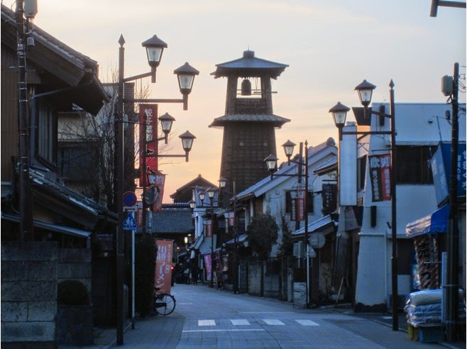
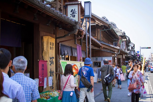
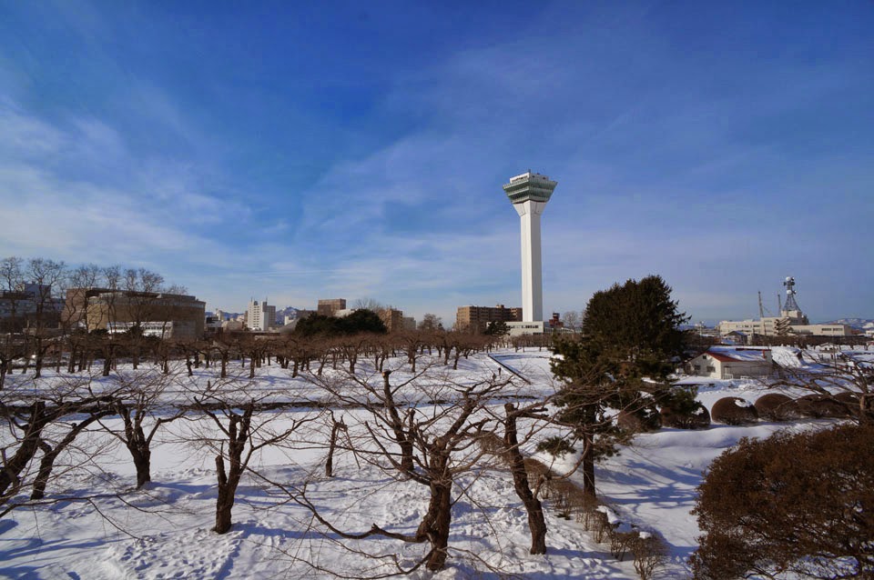
Circling around Hokkaido, we knew we wanted to go to cities like Asahikawa and Sapporo. From Kushiro, the most logical route was through Abashiri, a small port town that is also known as a transport hub in Hokkaido. Before our departure from Kushiro, we crossed our fingers and hoped that rain would not delay our journey; fortunately, it did not, and it took us all of 3 hours to arrive in Abashiri. This route is covered by the JR Pass. Kushiro to Abashiri was largely a coastal route, offering many nice views along the way. In Japan there are an indigenous group of people called the Ainu. Again, I’m not a history buff, but there are theories that they are related to the group who first inhabited North America. Some of the artifacts throughout town remind me of Eskimos. Abashiri doesn’t look as rundown as Kushiro, but like Kushiro, is a small and quiet city.
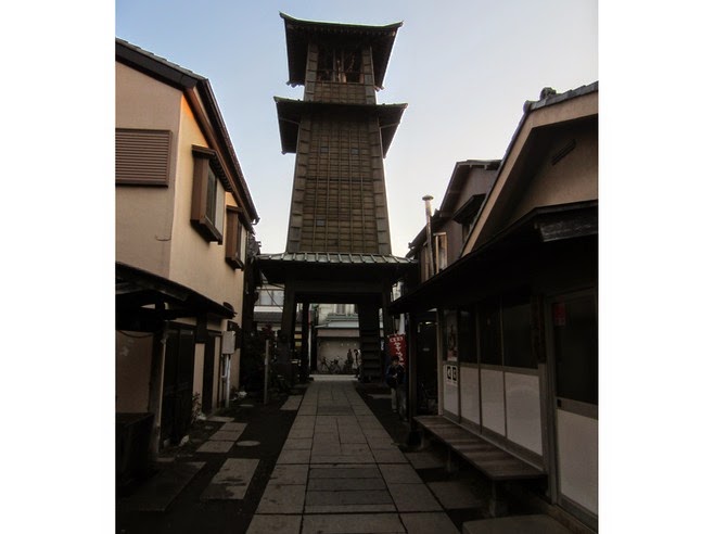
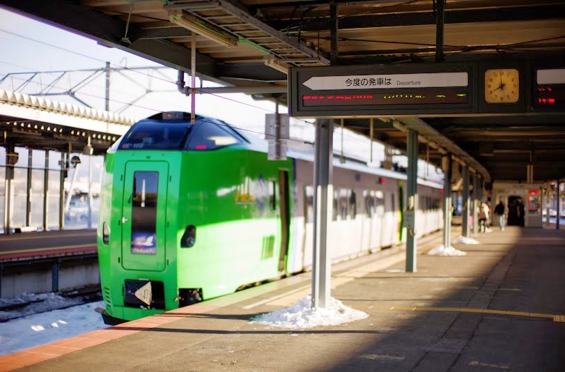

Abashiri JR Station 

First Time to Abashiri


I went from Wakkanai to Abashiri, to get to Abashiri, I had to go south to Asahikawa, then take a different train to the northeast. At first there was a bit of gnashing of teeth deciding where to go and how long to stay there. Seven days is not that long when you want to see stuff. Then I remembered that my original desire was about the train rides, not where I ended up. It became easy then. Other than Nemuro, I did a different town each night, reserved a room at a hotel in walking distance (with my heavy suitcase) from the train station and that was it. The destinations took care of themselves; I just wanted to travel as far as possible and definitely get to Nemuro.


Abashiri is about an hour away from Kitami, and it is a very beautiful journey. The most memorable part of the journey was when we were passing by Abashiri-Ko (Lake Abashiri) and Izumi pointed out these giant birds on the side of the road. These were humongous birds, and I had to take a picture of them, but of course I had my puny 40mm lens attached to my camera. I quickly scrambled through my camera bag and attached my 28-135mm lens, and simultaneously pulled a U-turn and I started to take some shots. I had to quickly adjust settings, and then focus on the huge birds of prey, and continue repeating the process until I got the right aperture. From the 15 photos shot, I was really happy with two of them, and you can see them below. When I got a home I did a little research on the birds, and it turns out that the birds are called "Steller's Sea Eagle" and it's actually pretty rare to view in the wild. Below are my two favorite shots of the birds.


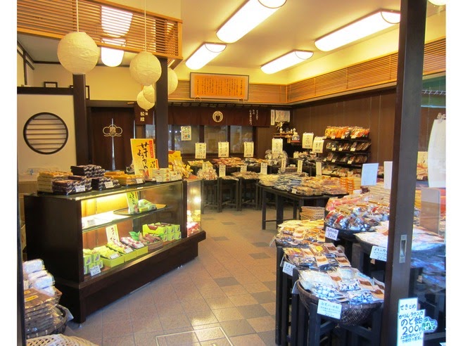
I arrived in Abashiri, I immediately went to check in to the hotel, it was old and kind of lousy but was functional. Also when I first got out of the train station, I was surprised how lousy this town looked like. It looked like any depressed small town in the interior of B.C. Maybe this was because Hokkaido was only settled in the late 19th century and so it doesn’t not have any of the traditional neighbourhoods that you see in old small towns in central Japan. There were no Japanese style houses anywhere in town, it just looked like your typical North American small town with parking lots, and buildings scattered everywhere. When I first arrived at the airport in Sapporo, I made a reservation to go on the icebreaker at Abashiri, but I made the mistake of making the reservation too close to my train arrival time in Abarashi. And since I already paid for the tickets for the icebreaker tour, which was 3000 yen, I needed to get to the ferry terminal quick and I had missed the public bus, so I decided to take the taxi. I had never taken the taxi in Japan before and its really expensive, it only took 10 minutes to get to the ferry terminal from the train station and it cost me 1170 yen. When I got to the terminal, I was surprised that there was so many tour groups there, lots of domestic Japanese tours and lots from Taiwan.

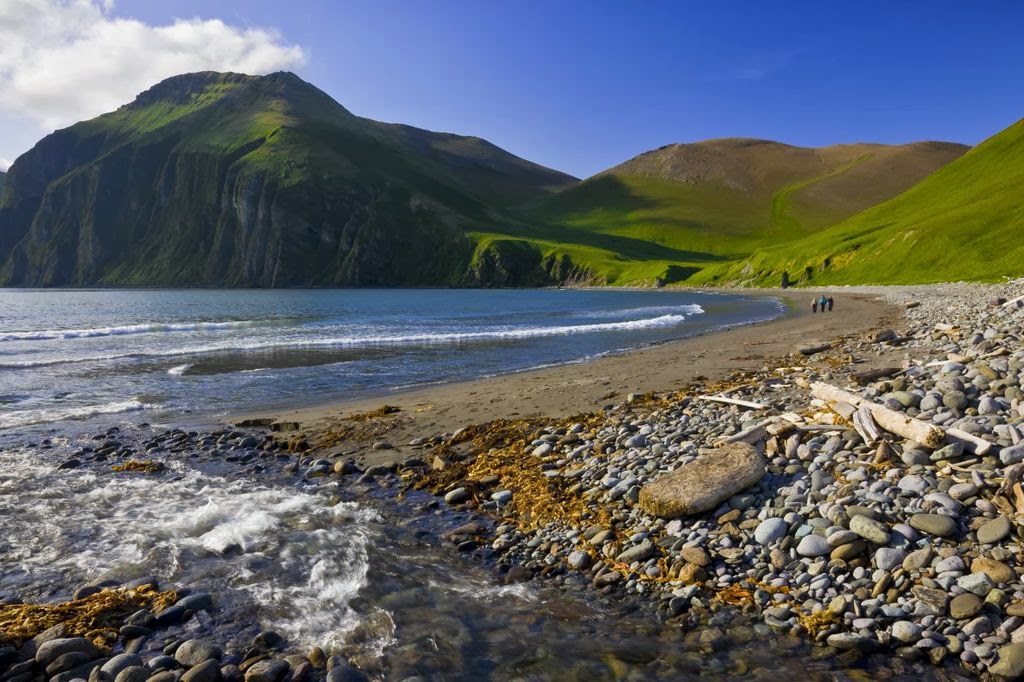
The Abashiri beach facing to Okhotsk Sea


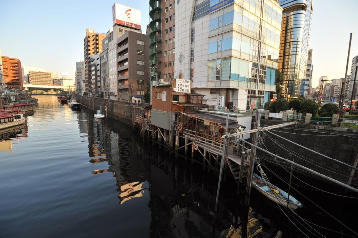
The Abashiri Harbour

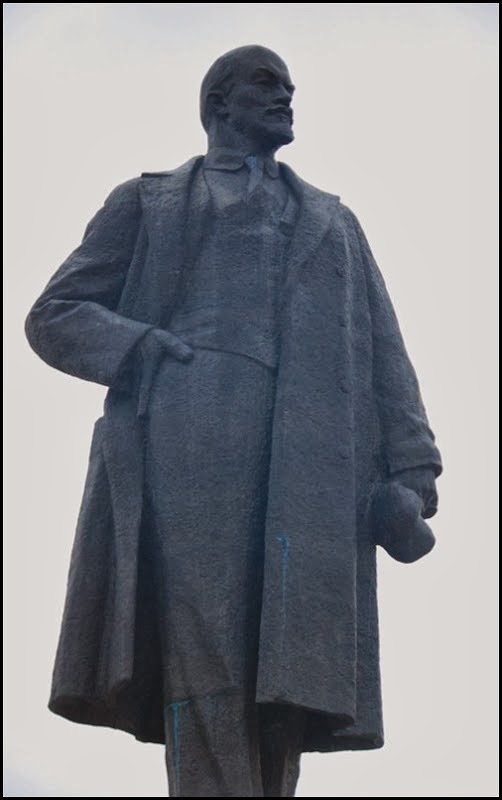
The stute of Ainu Hunter at the harbour

I was really disappointed that there was NO ICE in the Sea of Okhotsk, it seemed that it had all melted, I assumed that late February was still cold enough for the sea to be frozen because it was still really cold. Since there was no ice, it was like a cruise for 1 hour around the sea. There were lots of birds following the boat, and lots of tourists were buying snacks from the gift shop and feeding it birds and then photographing the birds eating the snacks. After that I decided to walk back towards the station because it wasn’t that far and I wanted to see what the rest of the town looked like. It was a really depressing town, almost no one on the streets, and the main shopping street was really deserted and this was in the afternoon. Since there was much less to see than I anticipated, I went to the train station to reserve a ticket for an earlier departure the next day. That night I went to a family restaurant (in Japan “family restaurant” is like Dennys-style type restaurant). I went there because there was nothing to eat near the train station except for this place. This family restaurant was unusual in that it served almost all meat dishes.

Abashiri Famous Crab


When you visit Japan, you can expect to have outstanding seafood wherever you go, but among the Japanese one region has especially good seafood. That famous region is Hokkaido, and the fish coming from this region is said to be the best due to the cooler waters that surround Japan's northern most island. Hokkaido may be famous for its fish, but as I found out Abashiri is famous for its crab. While at the visitor's center we saw a huge tank a little taller than waist height filled with live crabs. The tank was divided into two sections: on the left-hand side were giant crabs that from limb to limb were as long as my arm, and on the right-hand side of the tank were medium sized crabs that I could hold with my hands placed together. I couldn't believe how big they were, but when I saw how much they cost I was more shocked. The Large crabs cost 8,900 Yen, and the smaller crabs were 4,500 Yen. When you convert the prices they come out to about 100 dollars for the big crabs, and 50 dollars for the medium crab. One thing that surprised me was the lack of color in the crabs' shells, but the next morning on TV their was a report done in Abashiri and they visited a crab processing plant. The program showed the whole process of how the crabs are cooked, and packaged. After the the crabs get boiled the shells get that bright orange you are used to seeing.
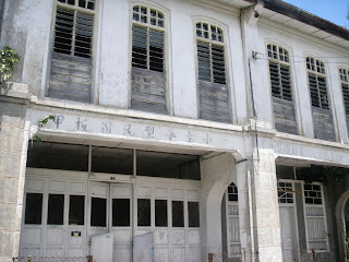
Abashiri Prison Museum

Museum Entrance

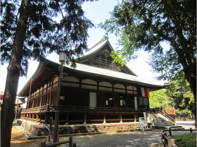
The top tourist attractions in Abashiri, the Abashiri Prison Museum. Supposedly, the name Abashiri struck fear in the hearts of Japanese lawbreakers back in the day, as Abashiri Prison was Japan’s first maximum security prison. Many of these prisoners were subject to hard labor (as opposed to execution, a sign of Japan’s ongoing westernization), and were responsible for building many of the roads in Hokkaido (under extremely harsh conditions). The prison itself is based on western design. The museum is the site of the original prison – the prison has now moved to a new location. Abashiri was able to oblige and provided an opportunity for the unique experience of visiting the city’s Prison Museum. During the Meiji Restoration period, the island of Hokkaido underwent a tremendous amount of settlement, development and expansion. With the restoration came a rise in the democratic rights movement and a subsequent increase in the arrest and sentencing of political prisoners. With an excess of prisoners the government sought to bring about a solution to their self-inflicted problem: Send the prisoners to Hokkaido.Abashiri Prison was one of five large prisons established with a mandate to use the prisoners as laborers in the expansion and development of land in Hokkaido. Agricultural practices were established and the prison became a center for soy and miso production as well as the labor behind the development of local and inter-prefectural infrastructure campaigns such as the main road connecting Abashiri and Asahikawa.


The prison cells

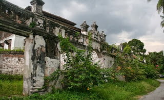
The grounds are massive and take at least two hours to see completely. There are 22 building areas in all; some have been completely restored while others are reproductions. You can walk through the agricultural processing areas, solitary confinement, barracks and administration buildings. Perhaps most impressive is the radial five-winged prison modeled after a similar Belgian prison with its guard house located at the center, allowing every wing to be monitored at the same time. One of the unexpected aspects of the prison museum was the life-like mannequins that are located throughout the various buildings. They are very realistic, some eerily so. If you get a chance to visit you may also notice that every guard was apparently required to grow a rather impressive mustache and at one point I couldn’t help myself and snapped a couple of photos. The cost for admission is relatively high at ¥1050, but if you stop at the information center at Japan Rail’s Abashiri Station, you can receive a discounted ticket for ¥940. Access from the station is by bus from stop number two (the information center can provide directions). The bus trip is only five minutes long — but you must tell the driver that you want to stop at Tentozan (costs ¥230 each way). From the stop it is a one kilometer walk up a gradually sloped hill.


The lives of prisoners are showing to us in this museum

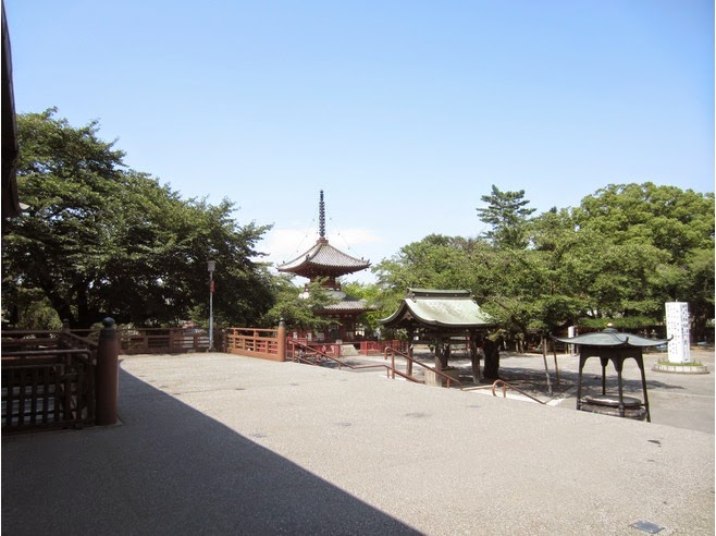
That's concludes of my vacation in Abashiri. For me, it felt more like a 24 hour layover. Though I'd walked around and checked out the Prison Museum, I'd felt like Abashiri would have had much more to offer had we had the means and the time to explore more. On the maps, there were lakes and coastlines to check out, but it would have been difficult for us to make it out because of our transportation situation; attractions in Hokkaido aren’t as well connected by train or by bus as they are on the mainland, making it more difficult for us to visit them. If you want to do sightseeing in Hokkaido, you’re probably better off by renting a car than by relying on public transport as there isn’t a ton of it.

Museum of Northern People


Nature's splendor is at Abashiri's door when you explore the largest town on the Okhotsk Coast on the eastern coast of Hokkaido. Colorful blooms delights at the Koshimizu Gensei-kaen garden, and a ribbon of trails through Shiretoko National Park afford stunning views of the Shiretoko Five Lakes. The Kamuiwakka Falls, "water of the gods," truly live up to their name, and in Shiretoko National Park you'll find five shimmering lakes, each with mystical properties. For the ultimate photograph, travel to the top of Mt. Tento, designated in 1938 as a place of scenic beauty, for panoramic vistas.


During the winter, the Sea of Okhotsk is renowned for its dramatic ice drifts, and a visit to the Okhotsk Ryuhyo-kan (Ice Flow Museum) offers a chilly yet thrilling opportunity to touch one of these drifts yourself. Abashiri offers a glimpse into the region's history at the Hokkaido Museum of Northern Peoples and displays its unusual history as a prison town in its open-air prison museum. The Dramatic morning market is a great place to sample local delicacies, including fresh-from-the-sea basket freshwater clams, perfect with an Abashiri Beer, the town's own microbrew. Unwind at the Lake Abashiri hot springs, the perfect end to a site-filled day.

However, if we had rented a car, we could have visited the northern coast of Japan which lies across from Russia; we could have visited Shiretoko National Park, a UNESCO World Heritage Site (that also happens to have very good uni, so we heard); if we came during the right times, we could have seen the drift ice and even seen northern aurora lights. There were a lot of what ifs during our stay in Abashiri, and that remains our impression of the city. There’s probably a lot more out there than we saw, so for now we’ll reserve our judgement on the place. It was just a one day layover after all.

Enjoy a refreshing time at the Tokyo riverside

$
0
0
The SUMIDA RIVER, Tokyo Bay and has Shitamachi (old downtown) areas on each side of its banks, flows through the northeast part of Tokyo. In times long past it served as a place of relaxation and as water for domestic use during the Edo period. It also has deep connections with peoples’ lives as a waterway that is tied to the economy. Currently, the river area is being developed as the “Sumida River Terrace” to create a new place for local citizens to relax. The Sumida River flows through Tokyo, running 17 miles (27 kilometers) around the city and passing under 26 bridges. It branches from the Arakawa River at Iwabuchi and flows into Tokyo Bay. The river is a great place to go on a boat cruise passing under the colorful bridges, viewing the Tokyo Skytree and Tokyo Tower, going past Shinto shrines, and getting closer to Tokyo’s river born heritage where the vibrant river systems served as the arteries through which its commerce flowed, from the Edo period to the present day.


Sumida River boat ride to Odaiba. After your time in Asakusa, walk over to the Sumida River by the Azuma Bridge to pick up a Suijo-Bus boat; the swoopy silver futuristic-looking craft will take you for a ride down the Sumida to the riverfront entertainment and shopping complex at Odaiba, which is quite a contrast to Asakusa. This terrace, which has been paved beautifully, is a place where many people enjoy walking and jogging. The flower beds inside the terrace are maintained by volunteers from the different regions, and during each season it’s possible to see locals having lunch while gazing at these colorful flowers. Events are also held at fixed intervals, including local festivals in areas such as Ryogoku, Akashi, and Hakozaki. Each time these lively events are held, they are attended by more and more people.


The “Super embankments” are also being installed together with the terrace. These broad levees are made of embankments with gradual slopes. The terrace and its rear embankments help ensure safety in the case of a major earthquake or flood, and also make people feel more affection for the river. For that reason, these embankments are planned to be installed along the entire Sumida River. Riding the water bus that connects Asakusa with Hinode Pier allows you to view the Sumida River Terrace and super embankments from the river’s surface. In this way you can discover new aspects of the Sumida River while listening to information from the boat’s guide about famous places and the bridges spanning the river that are visible from the boat. By the time you’re ready to leave Odaiba it’s probably night, so for some great views hop on the Yurikamome unmanned monorail. It will take you from Odaiba across the Sumida under a dazzlingly bright Rainbow Bridge, ending with some Blade Runner-ish scenery as you are deposited at the Shiodome subway station. There are restaurants, video arcades like none you’ve ever seen, tons of shopping, lots of manga-related places and every Gundam reference you can imagine.


Each year on the last Saturday in July, The Sumidagawa Fireworks Festival takes place. The festival is a revival of the celebrations that were held during the Edo period. Similar events take place at same time of year at other locations throughout Japan. The great summer festival atmosphere that accompanies the fireworks draws close to a million celebrants, many of whom are dressed in yukatas. Folks stroll around in Asakusa, especially around Sensoji Temple, and patronize the food vendors and game stalls lining the streets. In addition, many of restaurants in the area provide outdoor seating where you can enjoy delicious food while watching the fireworks.


The best places to view the fireworks display are right along the Sumida River itself. One area stretches from the Sakura Bridge to the Kototoi Bridge while another is located downstream of the Komagata Bridge to the Umaya Bridge. For most tourists, I would only recommend visiting the Asakusa to Ryogoku section of this river. The main reason is that the entire river is long and that’s the only section which would be interesting to a casual tourist. Even for residents, I wouldn’t recommend visiting this area unless they lived in the nearby area. If you are a runner and looking for a nice place to run, and you happen to be staying in Asakusa or somewhere near the river, I highly recommend that you go for a run if you have the time. It’s a wonderful experience and being able to run part of the area is worth it. It’s better than trying to fight your way through traffic and trying to avoid getting hit by cars on the regular streets.

Vladivostok - "Possess the East"

$
0
0
After travelling from Kamchatka I spent another night in Khabarovsk before catching the train the next evening to Vladivostok. I used the day to update my blog and catch up on some things on the internet – scary how used we got to the internet, 2 weeks without it and you can spend a whole day catching up on the most important things. After an unspectacular overnight train ride, I got off at my final destination: Vladivostok! I cannot really describe what I felt in that moment – something between extreme satisfaction, happiness and surrealism. For so long I was dreaming of doing this trip, getting off the train in Vladivostok I realized: I made it, I actually did :) I took the obligatory picture of the final mark of the Trans-Siberian: Moscow – Vladivostok 9288km. With all my extra rounds I probably travelled well over 10’000km. 


Vladivostok can be translated to "possess the east" and is a port city on the pacific and the end of the Trans-Siberian rail line. It houses the Russian pacific fleet in the golden horn bay and was closed off to foreigners during the Soviet era, reopening again in 1991. It is sometimes called the "San Francisco of Russia" due to it being on the ocean and the hilly area on which most of the city sits. The city is the midst of a construction and development boom with a couple of bridges, several large scale hotels and new roads in the works for the APEC summit the city is set to host in 2012.


In Russia all the signs are in their script, making transportation and navigation, at times a challenge. When in doubt we asked someone. More than likely they didn't speak English, but we learned the phrase 'nappi-shite' which means please 'write this.' Communication was challenging, but a smile keeps everyone happy enough, even to the tough and unapproachable looking! The people we interacted with were friendly and helpful. The lodge owners were more than happy to have us, some were even amazed at how we'd managed to travel the distances without speaking Russian. Independent foreign tourists outside Moscow, were few and only seen in the hostels. They passed on a few good tips and hints to help us along our way, like the time we rented a rest room at a train station. The hostel workers helped us with planning our next leg of our journeys too.


Fashion here is somewhat questionable. Poverty is evident in the quality of dress, infrastructure is developing as in all countries economic diversity of the people and its land is present when travelling around. The cities are city like, with shops and bussling people going about their hectic lives. Suburbs are typical of that of housing areas some in need of development. The rural countryside areas, are that of my interest as you can see more genuine culture and ways of life occurring. It was interesting to see Russian designed roof tops and gardens full of vegetables, displaying a relatively self-sufficient life styles.


Russian food, i am still questioning. What is traditional? I ask myself as we can't read the menus! We've eaten lots of potato pies, which are really mashed potato in a dough like capsule, they fill a hole when hungry. They're sold everywhere! When staying at a lodge in Lake Baikal, we were fed a variety of food. Pasta, cheese topped rice and cold stew for breakfast, fish for tea. Our favorite being pancakes with homemade raspberry jam! I had an amazing pancake in Irkutsk, with condensed milk and walnuts - yummy! Russians drink a lot of beer and vodka. There is always glass to be found on the towns pavements and in the parks. Frequently you'll see someone drinking and the odd drunk in the cities.


Russia is a sort of time-warpy place. The city is the same as any other city in the west but it's like the people decided the 80s were so great they'd just stick with that. You see lots of girls in ripped-up jeans and stone-washed denim jackets, but the height of female fashion appears to be based on “80s action-movie hooker”. The mens' fashions aren't so obviously 80s but there are still lots of gold chains, mesh T-shirts and crushed-velvet jumpsuits. The Russian visa is a fun one. hostel entrance pretty welcoming I think you will agree. It took me six weeks just to get all the documents I needed before application. It is also one of those countries which has different visa application rules for different countries.


Walking around Vladivostok is really nice, particularly on a sunny day like this one. Students that haven't left the city are out and about looking hipster and the city has a San Francisco feel to it. Nearby are some war memorials and the submarine musuem which is fun to explore as you literally walk through a used to be functioning Russian submarine.Its an S56 built in 1936. S-type submarines (S for Stalinist) were recognized as the most effective ships of World War 2, as effective as 14 German ships. Moving on towards Vladivostok was interesting. It was unbearably hot, the sky was blue and clear. Every time I’ve been blessed with good weather. Somewhere, in Ussurisk, the weather changed. In one second it went from being warm and sunny to misty, cold and foggy. Fog is the usual weather of Vladivostok, I heard. It is a thick version, that would be every still-photographers wet dream.


Out in the country side the pace is relaxed. People have their backyard gardens and sell the produce on the side of the road. You can still see glass insulators on the hydro poles, people cutting grass with scythes, jungle mat fencing, and water comes from what we would Round Bales and Wishing Well.Round Bales and Wishing Well. Round Bales and Wishing Well. It gets busy in the evening.call 'wishing wells' They sell a small single furrow plow - it is really just an engine on wheels like what is used in small rice fields - ideal for the large backyard gardens. And notice all of the wild flowers in the fields.


Vladivostok is a beautiful, busy port city, with pre-Soviet style buildings down town, and lots of Chinese tourists from just over the border. Everyone seems to be getting married.

Hakodate - More Spectacular View

$
0
0
My first stop in Hokkaido Island, Northern Japan it was the city of Hakodate (函館 = Box + Building) located just on the other side of the ocean separating the two islands. As the crow flies it's only about 100km from Aomori but the train takes a more scenic route in order to cross the ocean at the narrowest point. This connection between the islands is done via the Seikan Tunnel. The name (Seikan) comes from joining the first characters of (青森) Aomori and Hakodate (函館). The reason it's not pronounced Aohako is due to the fact that each kanji as a number of different possible readings (or pronunciations). The two main types are the "On Reading", derived from Chinese, and the "Kun Reading" which is derived from Japanese. "Ao" and "hako" are both Kun readings while "Sei" and "Kan" are On readings. The Seikan Tunnel is significant as it's currently the longest and deepest operating rail tunnel in the world. The tunnel reaches a depth of 240 meters below sea-level (140 meters below the seabed) and it's total length is 53.8km (with a 23.3km undersea portion). All up and through the tunnel it's a 160km journey from Aomori to Hakodate by train, and since there's no more shinkansen the trip takes just over two hours. 

Seikan Tunnel 


The first train to Hakodate didn't leave until 8:24 for some reason so I had plenty of time to have my free breakfast in that day!. I went down just after 7am (around 7:06am) and found there was a massive line!. I guess everyone had been waiting until breakfast. I'm not really sure why they don't start earlier. After breakfast I had a little bit of a look at the Aomori morning markets. They were located under a shopping center in a sort of basement level. The markets were alright although not fantastic. Lots of fish and crabs and seafood. There was some other produce as well and I bought a massive apple from one of the stalls there. After the markets I made my way to Aomori station and caught our train. There's two types of Limited Express trains to Hakodate, Hakucho (白鳥 = Hakuchou = White + Bird = Swan) and Super Hakucho. I don't think there's much difference but I wanted the super because it sounds better. I'd just had the regular plain old Hakucho though. One thing I did notice though was that the Super Hakucho that I got from Shin-amori a few days ago had maps on the backs of the seat with Seikan tunnel crossing times marked in. The Hakucho did not have these and I was a bit miffed about it as I didn't want to miss the entrance into the tunnel. Anyway the train ride was fun and offered many nice views of the ocean. There were also lots of tunnels before the main one! I kept being ticked as I wasn't really sure if the I were in at the time was the real deal! Some of the smaller ones were rather long too. I realized after about 8 minutes into the real one that it must be the Seikan tunnel. The tunnel itself was pretty uneventful. Just like any other tunnel I guess. At one point though I remember seeing an underground station flash by which was exciting.


There's two underground stations within the Seikan Tunnel although only one is currently operational. Yoshioka-Kaitei Station on the north side serviced its final train in 2006 and was the deepest railway station in the world located 149.5 meters below sea level. A few trains a day still stop at Tappi-Kaitei Station which is located on the south side of the tunnel and is connected to the surface by an underground cable car. I'd really like to visit this station as it contains a museum and it's cool that it's so deep. I fear I will not get the chance though as it will be shut down around 2015 when the Shinkansen starts operating through the tunnel. Once this happens they will continue to maintain at least one of their original functions as emergency escape routes. After I'd exited the tunnel I'm pretty sure I saw the Hokkaido Shinkansen under construction. I arrived at Hakodate on time at around 10:30am. Just like in Aomori the next train was waiting but this time bound for Sapporo. That was not I though so and I'd exited the station and after getting our bearings, crossed the tram tracks and made my way to the hotel. It was another comfort and since it was before check in time I just stored my luggage.


Fort Goryokaku

I thought I'd head to Fort Goryokaku (in the north east) first and then return back past from my hotel and continue onto the red brick warehouses, Motomachi and finally Mount Hakodate (in the south west). To get to For Goryokaku I'd rode the tram from Hakodate station to the Goryokaku Koen Mae stop. When I got off I asked for a day pass from the driver. The pass came with a lot of information and little booklets, apparently they enable you to receive discounts and such at tourist attractions. It was about a 600 meter walk from the tram station to Fort Goryokaku. Before having a look at the fort itself I went to Goryokaku Tower. This 107 meter tall tower was built in 2006 and offers views of the fort, Hakodate and the ocean and mountains in the distance. It wasn't very busy when I went in so I paid the 840 yen administration and went straight up. I'd showed our tram pass when I bought my ticket and received a complimentary post card each. Goryokaku Fort is a huge citadel built in the shape of a star. It was constructed around 150 years ago in order to defend Hakodate against western powers. It also later served a part in the civil war between the Meiji government and the Shogunate. Since 1910 however it has been a public park and due to over a thousand cherry blossom trees it is a very popular flower viewing (Hanami) location. The views of the fort from the tower were amazing. It was massive island of green and blue in the white cityscape and you could easily see the star shape.


The tower had slanting windows so you could learn over and look straight down with ease. I love how the tower was built for the sole purpose of providing view of the fort and Hakodate. I thought that it was a good advertising opportunity they took advantage of there!. After descending the tower I had a bit of a look around in the souvenir shop at the bottom, the tower mascot was really cute! It was basically just the tower with arms and legs- his antenna was a particularly endearing charm point. I regret not buying one of the plush toys. They even had a little bio on his likes and dislikes. I left the tower and walked the short distance to the fort, looking back at the tower I found that I couldn't see the antenna! That was a bit disappointing. To get into the fort I had to cross a bridge over a moat. Just before the bridge and off the path a little bit there was a shop playing music which had a sign saying "貸しボート" (Boat rental). I wanted to give it a go but I were too scared to go in and ask as no one else was renting any of the boats. So I continued across the bridge and into the fort. The old magistrates office is located in the center and although I didn't go in and I had a look at it from outside. I continued walking all the way to the back where I climbed up to the top of the rim of the earth wall surrounding the fort. I followed the path up there all the way back around to the front entrance (except in places where the road cut through). A number of places seemed pretty dangerous as it was a steep drop down to the water below.

Motomachi Heights District and The Old Hakodate Public Hall


Next stop was the Motomachi district which reached via a ridiculously steep hill. I tried gritting my teeth and running up it for a bit but I must've been slightly dehydrated as that gave me a headache. When we were about half way up a big tour group appeared at the top of the hill and watched me to struggle up!. Once I got to the top of the hill I turned right into a nice looking street that appeared empty. As I walked down it though it exploded with vendors hawking their food. There was one lady trying to sell me a hot milk! The last thing I wanted! I were all sweaty! "Atatakai gyuunyuu, ikakadesu kaaaaaaa?" While pulling it out of where it was being kept warm and pointing to it with her hand like they do on the telly. I didn't have a heap of time so I thought that I'd look in just one of the western houses. The Old Hakodate Public Hall. I had to wear slippers inside and they were really slippery on the shiny wooden floors! I was a bit worried I'd break my necks walking down the stairs. It was nice inside and there were explanations on what the rooms were used for in English.

You could go out on the balcony and when I went up there there were some Japanese girls done up in make up and who had old fashioned western style dresses on. They were looking mournfully out to sea like they were waiting on some lover at war or something and having their photos taken. I looked at one of them though she broke her pose and gave an embarrassed smile. When I went back down stairs I saw you could hire the dresses and pay to get the make up done to you. Not really sure why they all wanted to look so sad though. While I were at the Old Public Hall someone came up and talked to me. I think he started talking to me in English but I continued in Japanese. He asked me where I were from and was excited that I were from Malaysia("Watashi wa Mareshia kara desu"). He asked me how long I'd been here/japan?, how long I were staying?, if I were going to see more of Hokkaido?, what other places I were going to see in japan?, if I were students?, and where I learnt japanese?. Since it was nearly sunset it was time to leave Motomachi and head to Mount Hakodate! I walked back along the narrow street and this time there was a man very unenthusiastically trying to sell me the hot milk again. When I got to the ropeway station I saw that there was a heap of taxis lined up outside but when I went in I found that it was completely deserted. The cable cars were not moving either! I was looking at a sign when someone (I think she was cleaning) came up and said that it was not operating.

Mount of Hakodate


I started climbing the mountain straight away and for some reason there was a conductor lady on the bus who was narrating the whole trip. Along the way I could see the view from the bus already and it was looking pretty good!. I also saw a couple walking up the road and I wondered if it was because of the ropeway/bus not coming. It was a long/steep way to walk and the girl did not look happy at all. Since I arrived just before dust I could enjoy the view both during the day and the night as well as get to see the sunset!. The views from Mount Hakodate are considered one of Japan's three best night views and even during the day I could see why!. The ocean was wide and blue and had a number of ships on and it was really cool how it surrounded Hakodate on either side of a narrow strip of land. The mountains in the background were good too. There was a building (attached to the rope way station) that I had a look inside of but it was really crowded and there was much inside apart from a restaurant and a souvenir shop. I really wanted hot chips for some reason but the restaurant was full and they didn't sell them anyway. I went back outside and since I neglected to bring a jumper I was freezing!.

There's an old military fort nearby that I were considered visiting although since it was getting pretty dark and cold I decided not to visit. There wouldn't be much to do there in the dark. The building that I went into before had number of different outdoor levels and I were surprised going up as each time I thought that I were at the top that I found another level!. While I waiting for sunset I watched a young girl playing a Jyan ken pon (Scissors paper rock), with her mum. Whenever one of them won they'd go up the stairs and when they lost they'd go down the stairs. They kept playing for quite a while until the girl finally won! They both came close at times and it was a pretty intense game!. Sunset was amazing and soon after Hakodate lit up with millions of lights!. It was really pretty and while we took some photos- it's impossible to capture in a photo. One thing that contributed to the whole experience was how close I were to the actual city. Many other mountain views of cities are actually a fair way from the city but I felt like I were just above it. It had also suddenly become incredibly crowded! The outside levels attached to the building had become completely full of people. It was completely packed. Thankfully the ground level had relatively few people and I enjoyed the view from there.

The Hakodate Morning Market


The Hakodate Morning Fish Market is a must-see attraction for anyone visiting the city of Hakodate in the southern area of Hokkaido. The Hakodate Morning Market is located south of JR Hakodate Station, and as its name indicates, has many shops operating in the morning from 5.00 a.m.,(6 a.m. during the winter) to noon. The roots of the market are in farmers selling their products in the plaza in front of the station after World War Ⅱ. The market subsequently moved to its present location and developed into its current form. There are now over 450 shops mainly handing crabs, salmon, salmon roe, and other fresh seafood caught in the ocean around Hokkaido, but also including vegetables, fruits, dried goods, clothing and a wide variety of items. Visitors can enjoy meals made from fresh ingredients at restaurants in the market, with a bowl of rice tipped with sashimi!. The market is always very bustling, with over 1.8 million shoppers visiting every year. Markets like the Tsukiji Fish Market (found in most guidebooks for Tokyo) don’t seem to like tourists. Let’s face it, we ask a lot of questions, get in the way, and occasionally interfere with “regular” customers. The Hakodate Morning Fish Market, on the other hand, is specifically for tourists. They like talking to foreigners, love explaining their products, and don’t mind foreigners poking around the booth. With around one million tourists in the summer alone, the place is always bustling (while rarely being “over crowded”). The market opens at 5am and closes in the early afternoon, just after the lunch rush. They sell dried goods, fresh produce, fresh fish, live fish, and omiyage souvenirs at very affordable prices.


The donburi rice bowls vary in size, portion, and quality. Some of the shops advertise very cheap (albeit somewhat poor quality) donburi rice bowls for only 500yen. You can get salmon, ikura fish eggs, or tuna on top of rice. I recommend the ikura fish egg donburi rice bowls. While the average international tourist is unable to buy fresh fish or produce to send back home (import/export restrictions), they can enjoy fresh fruit and ice cream at the market. Hokkaido is famous throughout Japan for their high quality and deliciously fresh milk. The ice cream is made fresh from Hokkaido dairy cows and tastes heavenly. The shopkeepers at the Hakodate Morning Market peddle a variety of ice creams ranging from normal (vanilla and chocolate) to “Japanese” (black sesame and melon). If you are lactose intolerant (like me) you can instead munch on some delicious, fresh fruit – especially green melon. Japanese melons are very expensive; at the market you can see single melons selling for as much as 5000yen. My favorite part of the Hakodate Morning Fish Market was the ika squid fishing section. All throughout the market, you can see squid swimming in small tanks. When I asked a shopkeeper about it, he laughed and told me “Ika squid is best served fresh.” Little did I know that “served fresh” meant “served still wiggling.” For 1000yen, some shopkeepers will hand you a pole with a barbed end and let you fish for ika. Fishing itself is easy. You are supposed to hook the barbed end to the frontal, triangular section of the squid and pull upward. I caught one on my first try. The morning fish market is marketed toward foreign travelers. Naturally, they have some great souvenirs, ranging from dried fish to chocolates. I recommend picking up a pack of dried fish for a loved on back home (or so you can just snack on it in your hotel room like I did).


Supposed I want to visit the red brick house but due to time limitation & strong snow, I had to give up. I then need to proceed to next destination, Wakkanai. I had my lunch at the JR station. After the lunch, I went back hotel to collect the luggage, since the distance is very near. I waited at the station together with other backpackers. I then taken sometimes while waiting the time for boarding to take photos outside the station. Strong wind & snow made me feel so happy & excited. I love cold weather so much. The next Destination, Wakkanai the northernmost city in Japan.

Wakkanai - The Northernmost City and Faraway Place

$
0
0

I arrived at Wakkanai, whose name originated from Ainu word Yam Wakka Nay (ヤムワッカナイ), which means cold river water. To the Japanese, Wakkanai is a faraway place. In fact, it is the northernmost city in Japan. To us Wakkanai is indeed very far as it took me more than 9 hours of travel time from Hakodate in south Hokkaido with JR train. In a way to Wakkanai, the express stopped at Horonobe. I saw a very interesting guide board. Horonobe is; the middle of the Northern Hemisphere, town at 45 degrees north latitude, village of reindeer, in addition, cattle seems. Reindeer in Japan, I didn’t know that. So the landscape from Horonobe to Wakkanai looked somehow in Asahikawa two years ago. The train arrived at Wakkanai around 1PM. It took 9 hours from Hakodate. Hokkaido is big!. Wakkanai Station is the northernmost station in Japan. It’s located at 45 degrees 25 minutes 3 seconds north latitude. Wakkanai Station is northernmost station in Japan. Soyahonsen which has Wakkanai Station as the end of the station is the railway northernmost in Japan. Scallops are caught in large quantities in Wakkanai area. Scallop shell has been piled like as a mountain near the harbor. Russian fishing boat had been anchored at Wakkanai Port. The distance from Wakkanai to Sakhalin in Russia is only 42km. Sakhalin can be seen from Wakkanai on sunny day.


Soya Cape


Cape Soya where is the northernmost point of Japan, is about 20 minutes by car from Wakkanai.city. Terrain around the cape is gentle hills. Cattle had been grazing. Snow still remained in some places even in May of year. Northern Hokkaido is cold. The windmill on cape Soya was impressive. A lot of wind turbines have been installed on the hills of Soya. The development of renewable energy is desired more instead of depending on nuclear power generation. I visited a monument at the tip of Cape Soya. The cape was spacious. Mr. Hitoshi Shirota, who is a friend of mine gave me a tour of Sarufutsu village. The village is located to the south of Wakkanai. Sarufutsu is the largest village in Hokkaido. The main industries of Sarufutsu village are fishing and dairy. Many dairy farmers are dotted in the spread land. Sarufutsu has become as the representing place of scallop fishery in Hokkaido since the system of management fishery was introduced. Total fish catch is 50,000 tons per year. Of these, 30,000 tons are raised by releasing the juvenile scallop. Mr. Shirota gave me an explanation of the management scallop fishery. Scallop fishing areas are located offshore of Sarufutsu village and divided into five areas. The fishing place of the year is determined from one of five areas every year. Fishermen cannot go fishing to other areas in the same year. Juvenile scallops are released into the fishing place after the fishing period. Then fishermen have to wait five years to go fishing to that area. Scallops can grow during five year, fine scallops are fished again after five years. There are a lot of Itou (Japanese huchen) in the Sarufutsu river. Itou is called one of phantom fish but there are still many there. Anglers have come from far away. Sarufutsu village is managing also such natural resources. They are making effort to coexist with nature.

Wakkanai Giant Crab


Wakkanai is known primarily for crab, and its abundance of other fresh seafood throughout the year - the cold climate means it has access to stocks that would otherwise be out of season elsewhere. The main tourist complex is visible even from the station, is painted bright orange, and has a giant rusty crab on its sign. You can't miss it. The ground floor is a "market" for visitors, while the two floors above are taken by a food court or restaurant respectively. It's clearly designed to handle group tours though, at that time, I was the only one there. I ordered their signature lunch option, the tri-colour donburi (rice bowl) - sea urchin, ikura (salmon roe) and raw scallops on top of a bed of sushi rice. The miso soup has, quite characteristically, a crab claw thrown in for good measure. Likewise - scallop, ikura and especially sea urchin are some of the most expensive sushi ingredients available; only in a place like Wakkanai would all three be served so casually - almost recklessly - together on a lunch rice bowl.

The Wakkanai National Park


In the late 1990's Wakkanai was, in fact, a popular tourist spot, but in recent years it has ceded visitors to the zoo-bearing (and more central) Asahikawa, as well as the recently-appointed World Heritage site, Shiretoko. Nevertheless the tourist areas are still there, and I was off to see the first of them, the nearby Wakkanai Park. As much as I just loooove walking up steep mountain slopes (that's sarcasm, by the way, in case you need the hint) the view it offers of the town - and Sea of Okhotsk beyond - is stunning, and makes it totally worth it. Even from here, though, the view is spectacular. Basked in warm sunlight with a gentle sea breeze, the area was calm and serene, almost happy. It was actually really, really nice. Wakkanai Park itself has a bit of a colourful, if sad, history. Up until the year 2000 it was host to an amusement park and, until 2006, an aerial tramway and ski area. With the gradual decline in visitors the municipal government eventually decided to take down both, leaving behind only the park's imposing stone memorials and wind turbines - ironic reminders of a more glorious past. It is, in a way, a rather sorry reflection of Japan's own decline over the past two decades. Just one word of warning. Wakkanai Park is vast and wide, and clearly designed with cars in mind; those of you walking, like yours truly, might find yourself getting just a little bit more of a workout than you might have intended.

Noshappu Point


Having made it back down the mountain, I now headed to one of the other main tourist spots in Wakkanai, Noshappu Point. There's a bus which travels from the city centre to Noshappu, but it runs only infrequently and being young and reckless, I had decided to walk. The road from the city centre to Noshappu Point is flanked one side by the sea, and by warehouses and docks stand on the other. Fishing boats and nets line the road, in some cases blocking the path entirely. A dolphin clock and lighthouse mark Noshappu Point. There's also an onsen facility a little further down the road, and a small makeshift aquarium. It's clearly an area for couples, though the view really was quite pretty regardless. More importantly, though... it was getting dark, and I had an hour's worth of walking back to do. t was pouring down by the time I was back in the city which, of course, meant it was time for my final (and favourite) task of the day: dinner. 


I can't really make up my mind about Wakkanai. It's beautiful, but only in that common, quiet way that is a little hard to recommend to a visiting tourist. On the other hand... the seafood here really is sublime, and the isobeyaki - which remains a localised dish - quite possibly may have been my favourite of the trip. All in all... come here for the food if you're willing to travel a bit to try it, but know what you're getting into.

Aokigahara Jukai - The 'Suicide Forest'...

$
0
0
'The Sea of trees'

I ever explored the surrounding Aokigahara forest, and by ‘visit’ I mean I explored and almost got lost inside it. I doubt I will ever return to that forest again, it truly pricked every hair on my body and left me feeling cold and empty; the place undoubtedly has a disturbed or haunted aura. I went there because I am young and curious and thought ‘why not?’, I had read about it a year beforehand and was strangely fascinated by the place. A beautiful forest, where people choose to die… how strange I thought. It seemed to me the ultimate manifestation of yin and yang, life and death, contained in a place I never in my wildest dreams would imagine existing. However, I never told myself I would go there, I had no interest in seeing the place for myself, and was perfectly content just knowing about its existence. That is, until my friend Josh called me up last year and told me he had just booked a ticket to Japan, and that I should to. I bought the tickets that night, the tickets were cheap due to the tragic nuclear fallout, and I was always obsessed with Japanese culture, so it was a no brainer for me.

Aokigahara is a place where people come to end their lives. It is estimated that one hundred people die here each year. The ribbons are a precaution; if the person who is contemplating suicide changes their mind at the last moment, he or she will be able to find their way back to the world of the living once more. Ribbons are required because compasses simply don’t function in this place. Something about the iron concentration in the ground interferes with them though inevitably, such naturalistic explanation has been superseded by all types of supernatural ones; the forest is so spooky and still, it is hard not to infer the ghostly presence of all the souls that have perished here. Walking along the floor of the forest is a beautiful but eerie experience; you move in a perpetual twilight, a place which is forever on the verge of night. Every now and then, the shadows are interrupted by a flicker of color here and there a thin, bright ribbons trail and shimmer from one tree to the next. Follow one of these, and it might peter away into the stillness but then again, it could lead you further and deeper still, toward something else entirely, to one of the forms which are so regularly found in this place; a body hung slack and dangling from one of the skeletal branches above.


There are lots and lots of trees and mushrooms and, one would expect, 
a few stray crisp packets and Coke cans too

Aokigahara Forest, which is located at the foot of Mt Fuji in Japan, is one of those places that few wish to visit. Most people who do enter the 35 km2 forest never return due to its reputation for having the second highest suicide rate in the world (first place goes to San Fransisco’s Golden Gate Bridge). An average of 70-100 bodies are found there every year, and many are left undiscovered. The forest was created when Mt. Fuji – an active volcano – erupted 1,200 years ago and the trees emerged on top of the dried lava. The forest is known by many names, Aokigahara (青木ヶ原), Jukai (樹海) which translates in English as The Sea of Trees), Suicide Forest, the Cursed Forest, the Black Forest, and finally the locals I asked in Japan called it ‘NOOO, don’t go there!’ while they made the shape of an X with their arms. Sadly, the forest has long been associated with death and evil spirits (even before it became a popular place for suicide) as ubasute is believed to have been practiced in its woody depths, which is an old Japanese tradition where the elderly and sick are carried up a mountain or into a forest and left to die – sort of like the story of Hansel and Gretel, except with old people.

Here is my copy of the Lake Saiko map. 
Circled on the map (bottom left corner) is the Lava Cave.

It was an odd and hauntingly beautiful forest to be lost in. The trees were growing on pure dark lava, their roots often stretching above the ground and wrapping around caverns, making it difficult to walk. The tree cover was so dense that G.P.S. devices sometimes didn’t function, and there were hundreds of long ropes tied to tree trunks. After all, there is reason the Aokigahara Forest, at the base of Mount Fuji, is called the “suicide forest.” Japan has more than 30,000 suicides a year — one of the highest rates among industrialized nations. On average, someone in Japan dies by his own hand every 15 minutes. Usually a man. The Aokigahara Forest is the most common place to commit suicide in Japan, and it is widely thought to be the second most likely site in the world, after the Golden Gate Bridge in San Francisco.


In 1960, Seicho Matsumoto wrote a popular novel called “Tower of Wave,” in which a couple commits suicide in Aokigahara Forest. These woods are described as the “perfect place to die” by the author Wataru Tsurumi in the book, “The Complete Manual of Suicide.” His best seller has been found next to many bodies in the woods, which is also known as the Yukai Forest, or Sea of Trees.

In addition, Mount Fuji is revered as a sacred site in Japan. Folk tales tell of ghosts and demons haunting the forest. There is also a long, romantic history of honorable suicide in Japan, from the Samurai avoiding disgrace to the kamikaze pilots of World War II. And suicide is less stigmatized in Japan than in many Western societies. I had entered the Aokigahara Forest wondering why so many Japanese travel there to commit suicide. I'd ever spent time for photographic shoot and wandering around the forest in summer of July 2012. For people committing suicide in Aokigahara forest most fit all three criteria. I imagine that someone who wanted to stop living would have died full of rage for the society that gave them so little. Also, many of the bodies are never found and sometimes even gobbled up by wild animals, in other words they’re not given the proper burial they deserve, and there’s no denying they all died unnaturally and violently.

Don't be surprised if you found any debris of human bones and bodies here

Mount Fuji can be seen from a distance

There was also a car park, which had a suspiciously abandoned looking car in it. 
There was nobody around and the hood was covered with leaves.

Forest rangers, who are faced with the grueling task of searching the forest’s depths and retrieving bodies, have reported hearing high pitched screams and wailing in the otherwise eerily silent forest. It is also said that curses (black magic) have been put on the trees by some of those who have chosen to end their lives – maybe they wanted to leave behind a final ‘fuck you’ to the world they saw as their prison. Spiritualists believe that the trees themselves are filled with a dark energy from all the death and depression they have absorbed from the volcanic earth it sleeps on. Another factor is that the forest is located directly in front of Mt. Fuji, long-considered sacred in Japanese culture. But whether it was the novel, or the history, or the religious significance, or some combination of all of those that started Aokigahara’s history of death, its momentum is only getting more powerful. Some spiritualists say that the mass number of suicides committed there since the 60s has caused the forest to become tainted, and that sadness and evil now permeate the roots of the trees there. The Japanese government is of the opinion that people just need a little convincing to stop killing themselves there (and stop killing themselves in general, but, you know, baby steps). As a preventative measure, they’ve erected signs all along the walking trails, asking visitors to think about their lives before deciding to die.

The fragments of human bones and shoes owned by deceased

"Your life is a precious gift from your parents. 
Please think about your parents, siblings and children. 
Don’t keep it to yourself. Talk about your troubles 
(or ‘Please get help, don’t go through this alone). 
Contact the Suicide Prevention Association 0555 – 22 – 0110"

The trails of Aokigahara forest has tied with rope on the trees around 
the route to prevent the visitors to getting lost in the jungle. 
Many cases of missing people has been reported in this area.

So what’s made this place such a popular last thing to ever see? Well, it is nice looking. I mean, besides all the dead folks. Some say that it’s related to an extremely popular Japanese romance novel released in the 1960s, “Kuroi Jukai” (Lit. “The Black Sea of Trees”, a nickname for the forest), which ends with a couple visiting the forest to commit a joint suicide. The novel portrays the act as beautiful and romantic, for which some blame for the current reputation of the forest. And culturally, Japan has never had a major issue with suicide. It’s never been illegal, nor has it even been considered morally questionable for the most part, until recent times. I feel like I shouldn’t write about what I saw in the forest beyond this point, as I don’t like the idea of portraying this place to be some sort of ‘ringu’ amusement park, designed to satisfy our hunger for our most primal emotion: fear. But, as this is my journal, I feel I should describe what else happened on my journey.


The place deceased of suicide

I don’t have any desire to try and sensationalise my experience in Aokigahara, even though it may seem like it to some. In all honesty I thought the forest was strange and fascinating, and not just because of its dark history. Everything was mossy and ironically full of life, it was also very quiet – at times this was creepy, and at others it was very peaceful. The forest is full of paradox and contrast. It is also physically very different to most forests, it is almost alien. For example, a lot of the trees were rooted above ground and looked as though they would start walking at any minute, while holes and crevices littered the forest floor and allowed its deep underground some air to breathe. Finally, the locals don’t call it the Sea of Green for nothing; the forest was suspiciously green, but nevertheless it was very beautiful, especially when you consider the emotions (good and bad) it could evoke in you at any random moment. I was surprised, actually, to learn that the forest was located at the base of Mt. Fuji, considering the mountain is synonymous with Japan (everyone knows about it) and yet few know about Aokigahara.

The jungle area is getting dark in late of evening 
and I heard something... (It's really horror...)

My experience in the infamous Aokigahara forest. By the time I'd started back tracking in an attempt to escape from the forest it was about quarter past 4, the sun was starting to set and it was getting very dark due to the tall canopy of trees which Ian’t letting much light in to begin with. Considering I got there at about 11 20 am and finally left at about 5 pm, I was in that forest for almost 6 hours. I don’t have any plans to visit the forest again, but who knows what the future holds. If I do ever come back, it will be for journalistic reasons and I would want to film a documentary about it. I wouldn’t go back just to ‘see’ it again. The locals fear this place, and I now see why, it is truly a haunted area. If you are looking for the macabre, then you will probably find it in Aokigahara. If you want to see ghosts, then come between the hours of 2 and 3 am.

本当の幸せ - Honto no shiawase (The Real Happiness)

$
0
0

幸福は健康にあり
富の未における蓄積
幸福は他人の世話にあり
親愛なる友人や兄弟のよう

幸福は共有にあり
集結されるわけではありません
幸せは心の状態です。

どこにも見つけることができます
瞬間をお楽しみください、人生を生きる
スコアをセトルし、争いを終わらせる

幸せは旅ではない宛先である
幸福はあなたの魅力は何やっている
幸福はあなたが好きなものをやっている
眠るウォーキング、ランニングや自転車に乗って

幸せは近く来る
するときは、恐れることなく思い切ってます
サービスをレンダリングすることのことができます
男を飾るの人生を生きる

世界中のイスラム教徒の人々へのイードムバラクハッピー。

純一郎長谷川@ジャシャムスルニザムマッドヤニ。 
荒川区、東京都。 
(Junichiro Hasegawa@Jashamsulnizam Md. Jani)
(Arakawa-ku, Tokyo, Japan)

Kawagoe: The Little Edo.

$
0
0

I went to Kawagoe myself during my most recent trip to Japan and had a very nice day, here is some more about the place also called ‘Koedo’ or ‘Little Edo’ (Edo is the old name for Tokyo). Located in Saitama Prefecture just north of Tokyo, Kawagoe is part of the so-called Greater Tokyo Area and serves as the governmental, commercial and business center of the southwestern part of the Prefecture. Most cities in Saitama, including Kawagoe, are suburbs of Tokyo, with many residents daily commuting to Tokyo. Kawagoe is conveniently connected to Tokyo by three different train lines, the Tobu Tojo Line, JR Kawagoe Line, and the Seibu Shinjuku Line. Based upon personal experience, the latter is very easy to get from Shinjuku (one of Tokyo’s major centers) to Kawagoe, as it takes a simple forty minute ride from one end of the line (Seibu Shinjuku Station) to the other end of the line (Hon-Kawagoe Station).

Exiting the Kawagoe station, it is a ten minute walk to the main attraction of the city: the historic main street in Japanese called ‘kurazukuri’ (traditional architecture). The street is flanked on both sides by old buildings made of clay and originally build as warehouses, reminding visitors how a town in the Edo Period (1603 – 1868) must have looked. The buildings are all different and from different time periods, the oldest one being from 1792. The historic main street is also home to the old and famous Toki-no-kane tower bell (see photo), which rings three times a day and serves as the symbol for ‘Koedo’. It is precisely for this reason, being one of the few places to have preserved such old buildings, Kawagoe has become known as Little Edo.

Another interesting place is the Honmaru Goten, the primary hall of the former Kawagoe Castle that has withstood the test of time. In 1870 the castle was largely dismantled, but some buildings stayed in Kawagoe while others were moved to nearby cities. The Honmaru Goten is one of the few parts of the former castle that has remained at the place it was originally built hundreds of years ago. In earlier times, Kawagoe Castle was an important strategic position as it was the first line of defense after Edo Castle, the castle of the shogun (military ruler) in the capital Edo. Kawagoe was also an important supplier of commodities to Edo and thus important to the capital’s economy. For these reasons and in recognizing the importance of the castle and its city, the Tokugawa shogun’s installed loyal, trusted and high ranking men in Kawagoe Castle as castle lords.

Gohyaku Rakan


The Gohyaku Rakan or 500 Statues of Rakan, is a collection of 540 small stone statues representing Buddha's disciples. These statues tucked into a small 20 meter by 20 meter square fenced in area, were carved between 1782 and 1825. While the rest of Kitain Temple is free to enter, visitors must pay about 300 Yen or so to wander among the Rakan statues. They can also be viewed for free from the gate inside the temple complex. According to legend, if you wander among the statues at night, touching each one, you will find one that is warm. In the light, you will see that this statue resembles you.

Kitakain Temple


Kitain (Kita-In) Temple is thought to have been founded in 830 AD. It burned in 1205 AD and rebuilt in 1296. In 1300, this great temple became head of the Tendai Buddhist temples in east Japan. The grounds house not only the main Kitain Temple, but also a shrine dedicated to the Shogun Ieyasu Tokugawa, and original buildings from Edo Castle in Tokyo. Because of the destruction to Tokyo in the 1923 Earthquake and World War II, the buildings at Kitain are the only remnants of the original castle. The Temple's most famous site is the 540 statues of Rakan, disciples of Buddha. The statues, carved between 1782 and 1825, are all unique.

Kurazukuri Warehouse


Kawagoe's Kurazukuri area is the most famous area of the town. Kurazukuri Street stretches about 200 meters and is lined with Edo-Period warehouses that are now mostly restaurants and shops. The warehouses are identified by their thick clay walls, a significant change from the wooden houses that were found throughout most of Japan. These warehouses were constructed by businessmen so wealthy they could afford to build these expensive fireproof structures. The businessmen were exceptionally wealthy due to their close economic ties to Edo (now Tokyo). The oldest house in this area was built in 1792, and is called the Osawa House. The Kurazukuri Museum is a historic Tobacco shop that is now open to the public.

Choki-in Temple: Skinny Buddha

In the historic area of Kawagoe, there is a small alley with a temple gate at the far end. Though the alley is quiet, it is inviting. The long, narrow, stone-lined path takes you past a few vacant storefronts and into the temple grounds. The shrine is eerily deserted except for a man in obvious mental distress, who greets you strangely but kindly with an odd military-style salute. Then he disappears into the cold afternoon. Looking around the old temple, your eyes are suddenly drawn to a shocking image--a statue of a man so skinny, he could be a survivor of a Nazi concentration camp. As you approach, you can make out every rib on the statue, and even the veins in his chest.


Somehow the imprint of his spine is almost visible through the barely existent stomach. Even more odd, the statue has five-days of whisker stubble on his chin and cheeks, his eyes are sunken into his skull, and his loose clothes are falling off of his body. This is the most unusual statue of Buddha you will ever see. The statue stands in front of the Choki-in Temple in Kawagoe. The statue is a replica of an ancient Third Century statue of Buddha that is supposed to represent penance. It is said that this statue depicts the time Buddha learned that he could not obtain enlightenment by torturing his body with starvation, after having barely eaten over the course of six years. The original statue is in Pakistan at the Lahore Museum of Art.

Confectionery Lane (or Penny Candy Alley)


Next to the northern end of the old Kurazukurai section of Kawagoe is a narrow, but crowded alley that often has more children than adults. This area is called Kashiya Yokocho in Japanese, or Penny Candy Alley in English. This street has been home to candy makers since the 1870s or earlier. Following the Great Kanto Earthquake of 1923, this area become the center of the Tokyo candy industry, with some 70 candy manufacturers. Today, about 22 candy stores survive, and they sell a variety of traditional and modern candies, along with toys. I wandered around this alley for about 45 minutes, stopping in numerous stores. Had some traditional steamed mochi filled with sweet potato and we bought some modern hard candy. I also noticed dozens, if not hundreds of Japanese carrying meter-long sticks of "fu," which resembles a loaf of bread, and is made of wheat and sugar.

Time Bell Tower, Old Kawagoe

The Time Bell Tower, or Toki no Kane in Japanese, was first constructed 400 years ago in central Kawagoe by Sakai Tadakatsu, a Kawagoe feudal lord. Though it has been burned and rebuilt about three times, most recently by the Kawagoe Great Fire, the present 16 meter structure dates back to 1893. While the tower stands in front of a temple, the tower had no religious purpose, instead it was used to tell time. Today the wooden bell tower stands as the symbol of Kawagoe. The bell still rings each day at 6am, noon, 3pm and 6pm.


The relationship between Kawagoe and Edo eventually led to close ties and Kawagoe inheriting many aspects of Edo’s culture and architecture. An interesting example is provided by the festivals floats used for the annual Kawagoe Festival, which is held for two days on the third Saturday and Sunday of October. In the Edo Period the hight of festival floats in Edo was limited as they had to enter through the gates of Edo Castle. Although Kawagoe Castle did not feature such a gate which limited the hight of the floats, the city eventually started to make festival floats in Edo style which meant that these floats could lower their tower by way of an ingenious device inside.


In other words, Kawagoe not only gives you an impression of how Edo looked in former times, but also feels somewhat ‘warmer’ and open than Tokyo. If you are in Japan, have some time and wish to escape from Tokyo, Kawagoe is certainly a nice place to visit!
Viewing all 42 articles
Browse latest View live